
VRJPALESTINE // DIGITAL REPOSITORY & FORENSIC ARCHIVE
Immersive Realities & Forensic Geography
Project Gallery
Welcome to the central case directory. This open-access spatial archive uses virtual reality reconstructions, detailed 3D modeling, and chronological aerial cartography overlays to document and counter historical erasure. Select any active case file below to inspect our architectural environments and verified testimonial layouts.
Archive Methodologies
Visual Pipelines
3D VR / 360° Environments
Empirical Layers
Cartographic Overlays
Access Tier
Public Registry
Index // Case 01
Palestine
Nakba Timeline: One Second for Every Depopulated Village
Timeline Reconstruction
Aerial Mapping
Forensic Archive
Index // Case 02
Gaza, Palestine
Story of Abubaker Abed
Timeline Reconstruction
Historical Mapping
VR 360
Index // Case 03
Palestine
Palestine: A Tale of A Shredded Homeland
Timeline Reconstruction
Historical Mapping
Animation
Index // Case 04
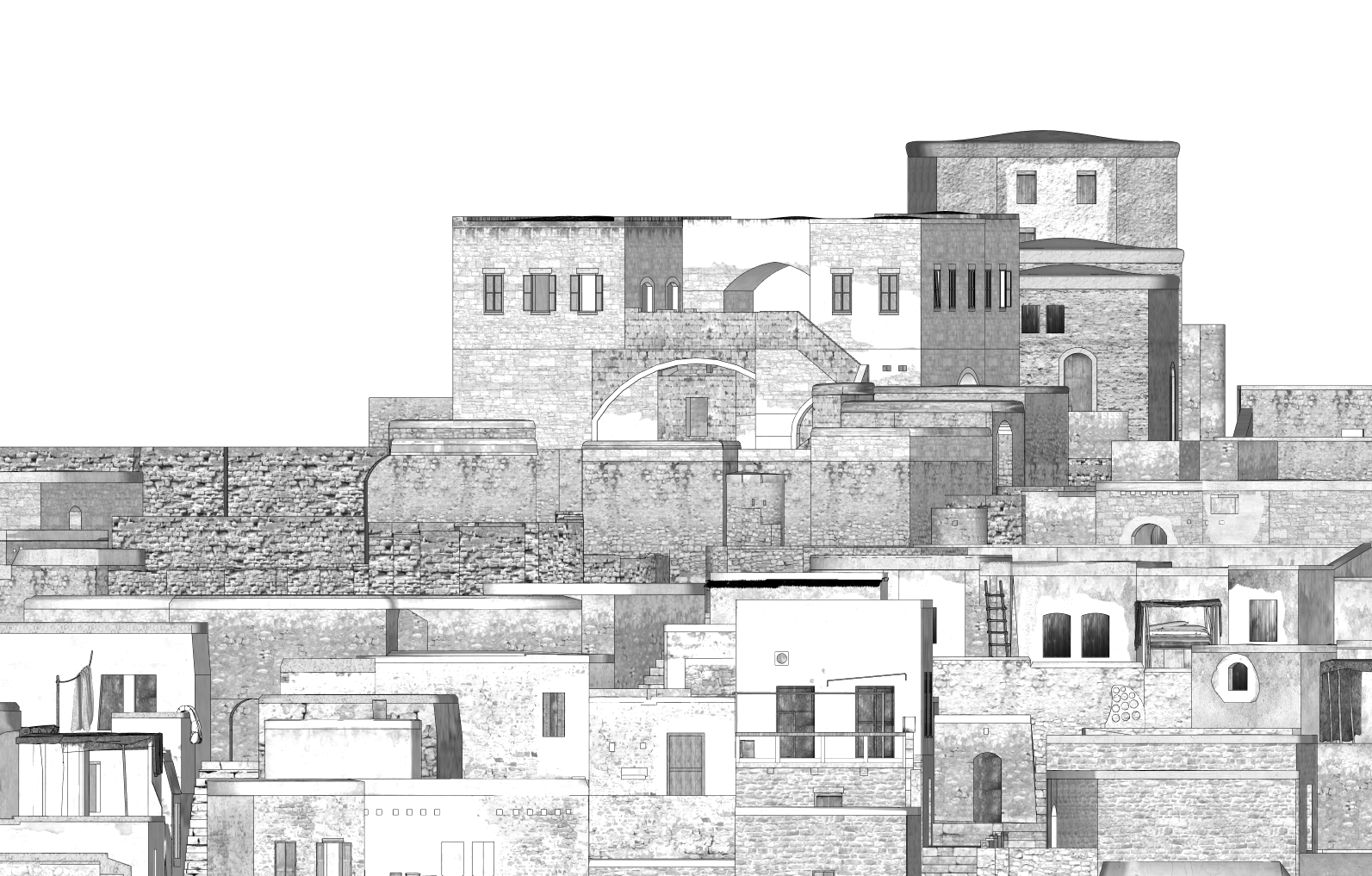
Jaffa Sub-District
Jaffa: Flashbacks
3D Reconstruction
Aerial Mapping
Forensic Archive
Index // Case 05
Tiberias Sub-District
Hittin: Remembered
3D Reconstruction
Aerial Mapping
Forensic Archive
Index // Case 06
Tiberias Sub-District
Zirin: A Return Journey
3D Reconstruction
Aerial Mapping
Forensic Archive
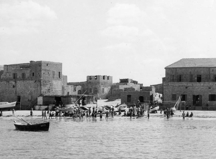
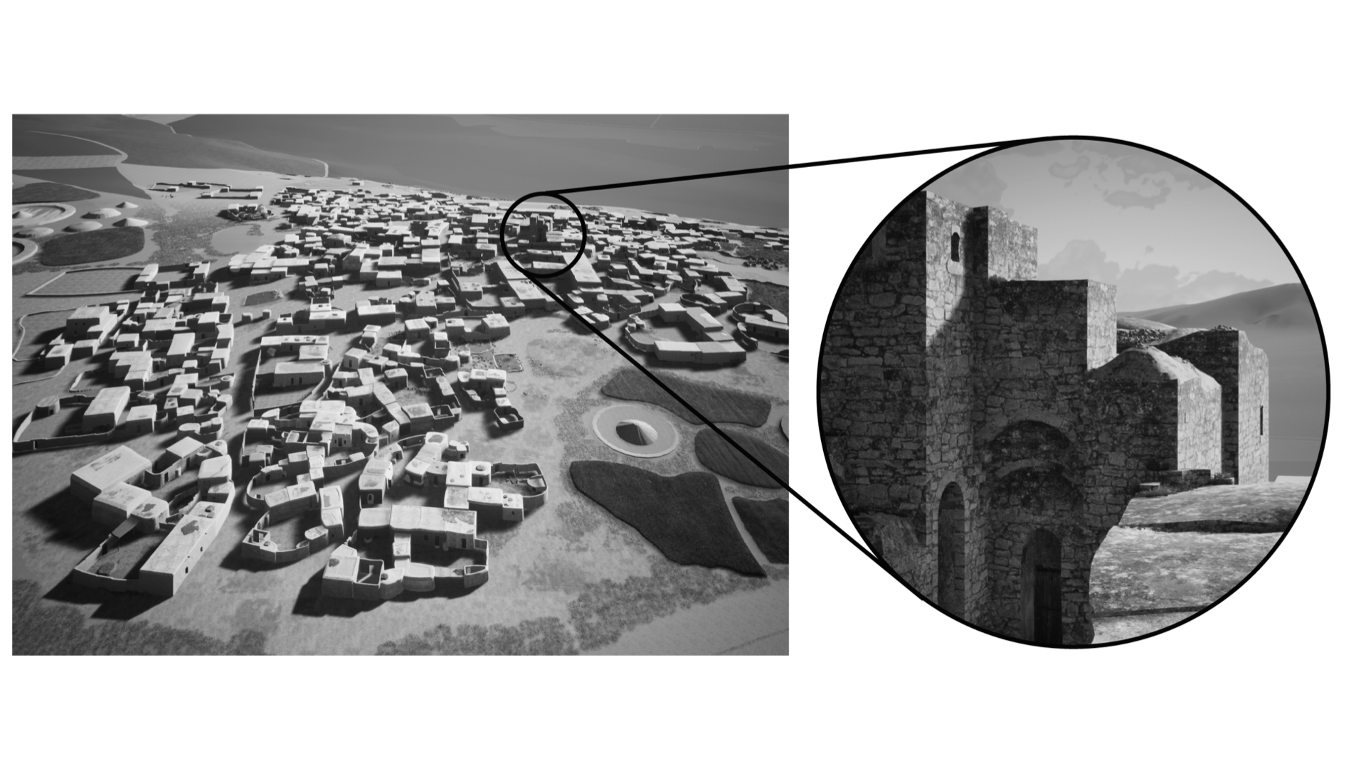
Index // Case 07
Tiberias Sub-District
Tantura: Memory Reconstructed
3D Reconstruction
Aerial Mapping
Forensic Archive
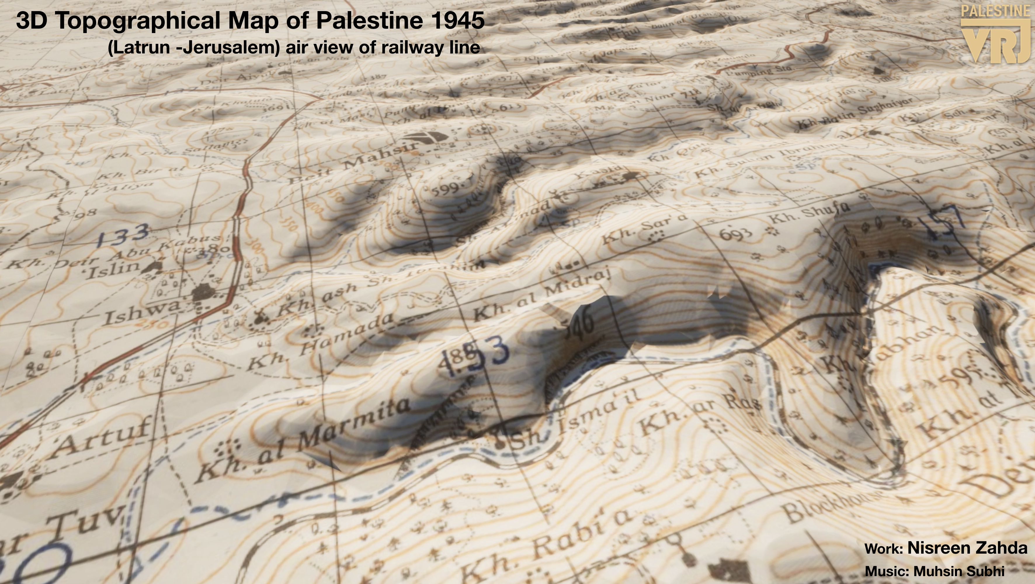
Index // Case 08
Palestine
3D Topographical Map of Palestine 1945
3D Reconstruction
Historical Mapping
Video
