
Enter Reconstructed Hittin
Interact with the memory of the landscape. Choose an entry node below to launch the real-time WebVR simulation. You can explore these spatial dimensions on desktop viewports via keyboard controls, or engage absolute immersive tracking using a calibrated VR headset.
Hittin: The Village Core
A comprehensive spatial traversal through the central domestic sectors of the village. Walk across the flat streets and terraced residential steps mapped directly from historical land survey coordinate boundaries.
Hittin: The Mosque Path
A focused historical itinerary beginning at the main mosque of the village. This experience emphasizes architectural preservation, utilizing verified optical alignments to reconstruct the minaret and crumbling interior arches.
The Architecture of Dismantling
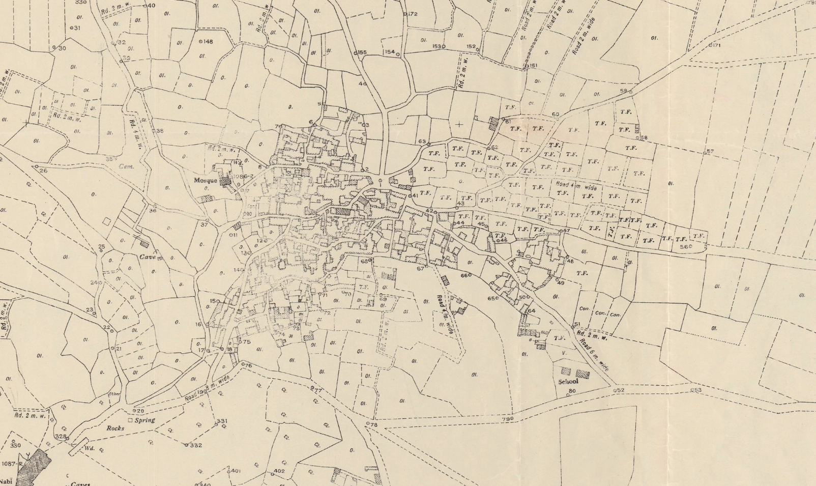
The physical removal of Hittin was not instantaneous; it was a multi-phased spatial engineering process designed to permanently break the relationship between the village community and its steep, terraced topography.
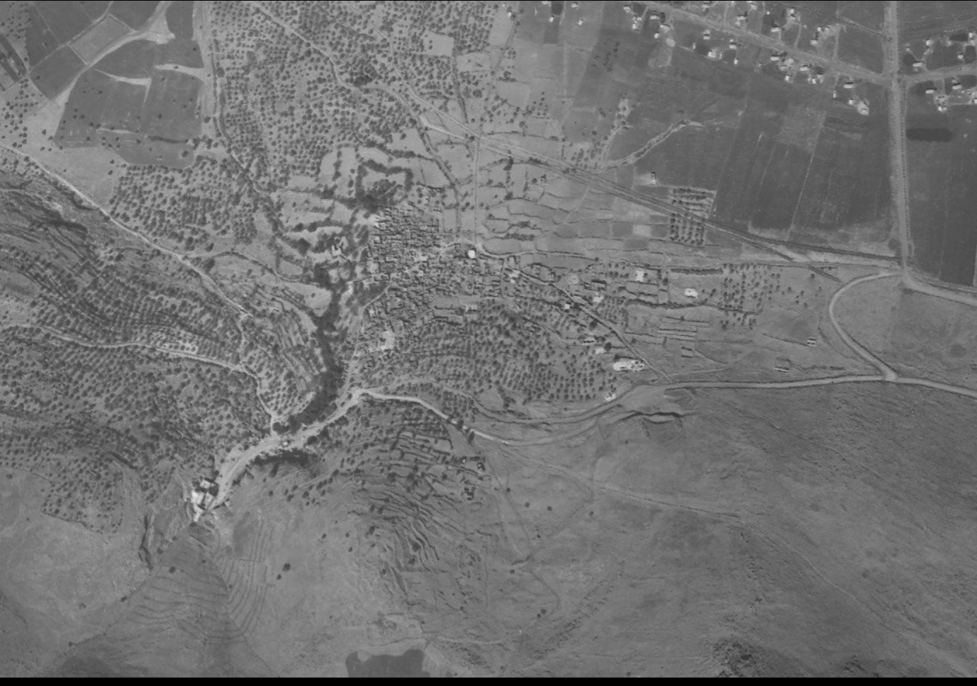
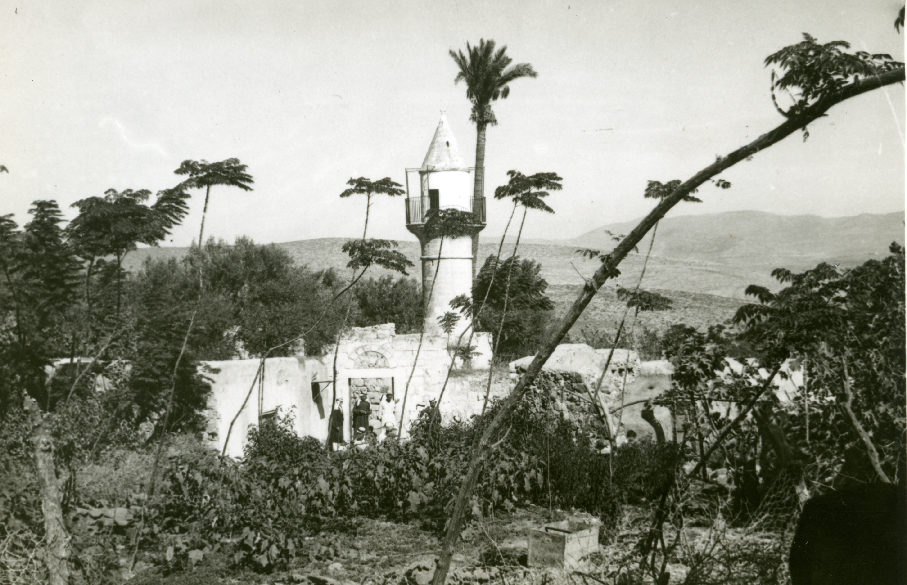
By comparing early records against aerial surveys from 1955, the mechanical systematic targeting of domestic vernacular fabrics becomes evident. Stone by stone, the structural core was hollowed out, leaving only deep institutional traces and the heavy masonry of the village mosque standing as isolated landscape markers.
Archival Assessment: The 1955 aerial matrix maps an altered landscape signature, documenting the clearing of stone rubble to make room for subsequent agricultural zoning.
Reversing Erasure via Immersive Reality
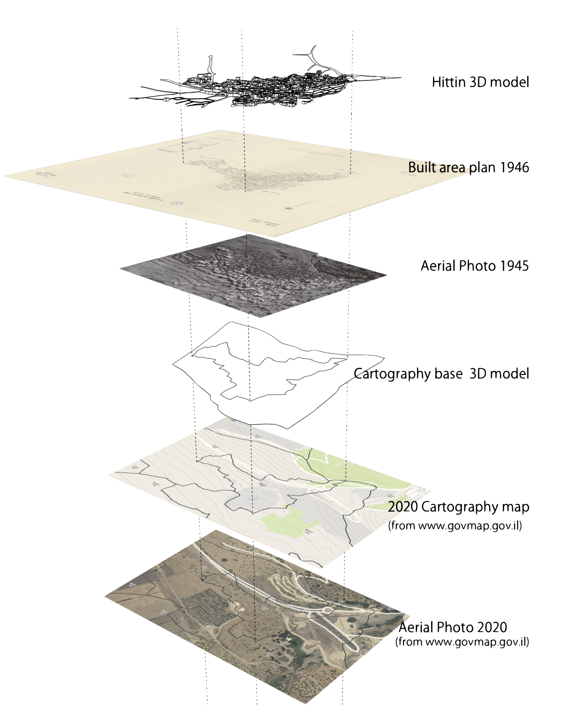
Our reconstruction process reverses this spatial dismantling by synthesizing cross-era data. By cross-referencing ground-level ruins with historical aerial matrices, we re-establish the accurate floor plans, volumetric scale, and precise placements of Hittin’s lost domestic complexes.
This digital environment serves as more than an archival model. By re-aligning individual stone structures back onto their native terraces, it provides an interactive space to challenge historical erasure and navigate the village layout as an intact, living architectural node.
Empirical Re-Alignment: Archive to Model
The spatial reconstructions do not rely on artistic speculation. By executing a process of survey layering and perspective matching, we calibrate the cameras within our 3D workspace to match the precise optics, focal lengths, and physical positions of historical photographers. This allows to empirically verify structural volumes against native terrain elevations.
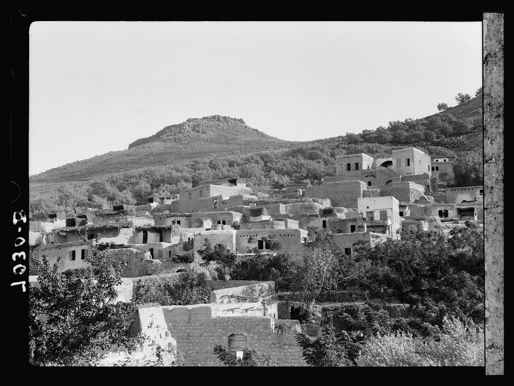
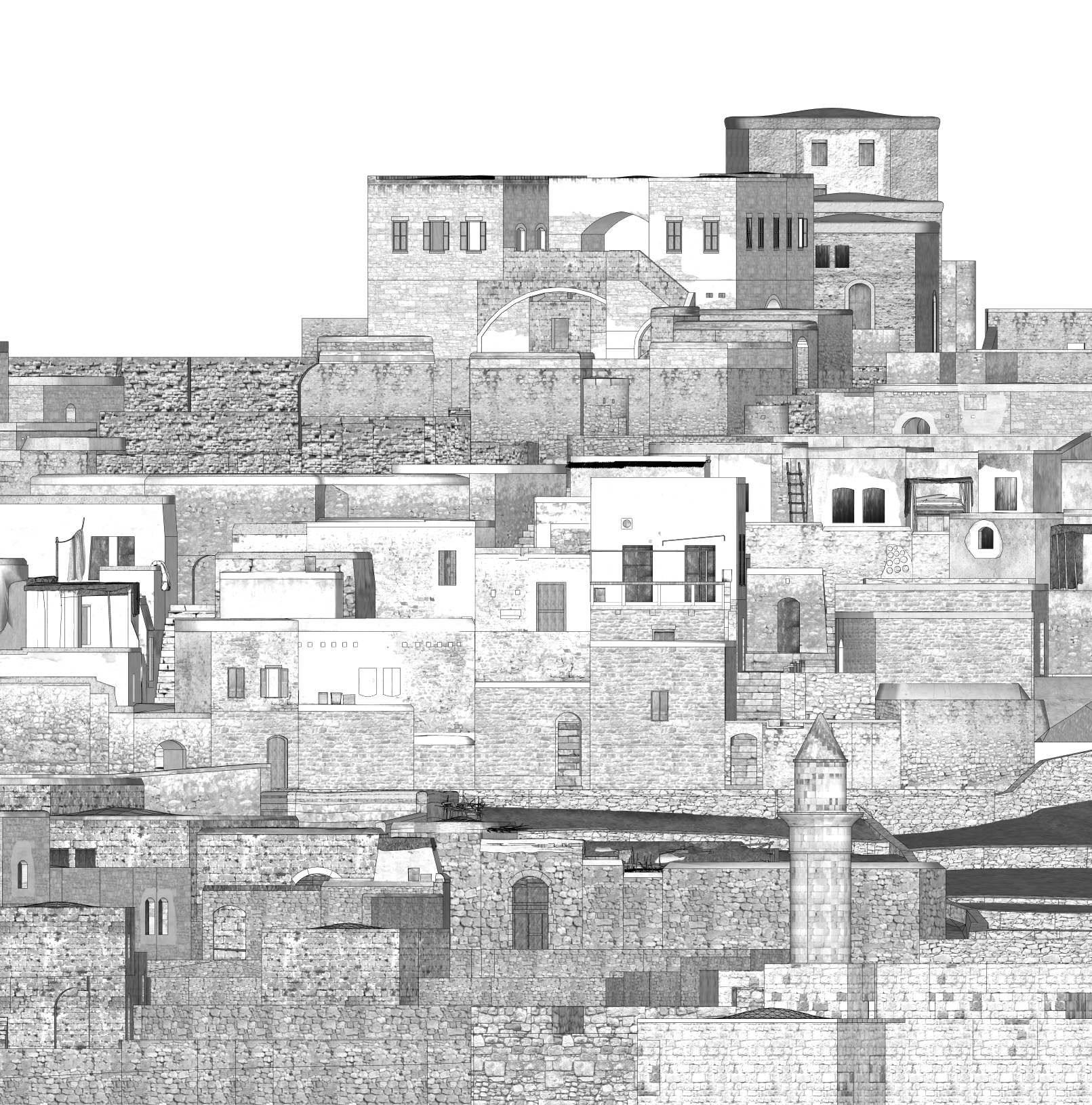
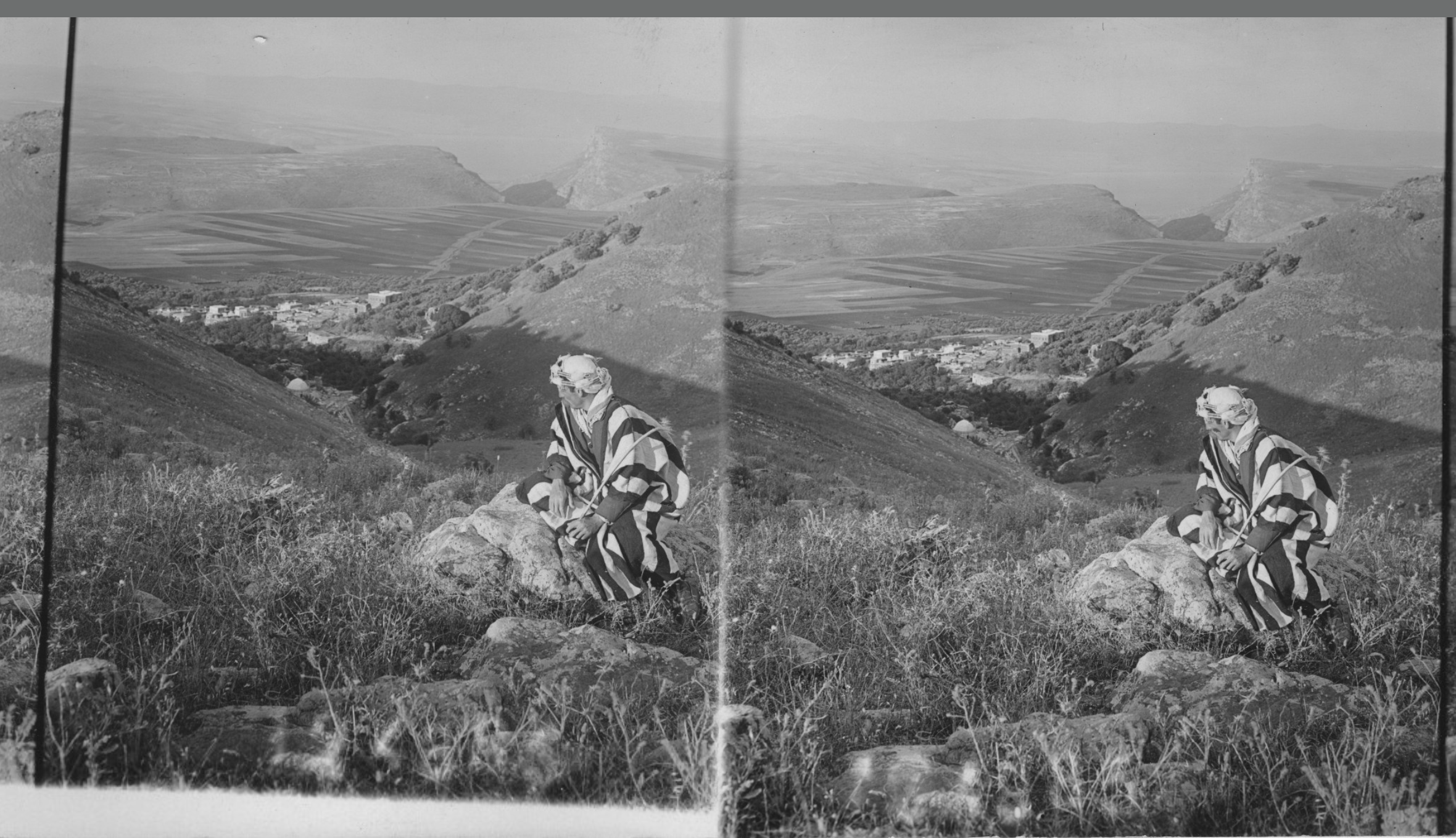
Historical Baseline Matrix. Ground-level reference photography capturing the organic integration of local mixed architecture of stone masonry and mud houses against the natural mountain steps. This panoramic structural baseline dictates the placement of individual domestic boundaries and pathway volumes.
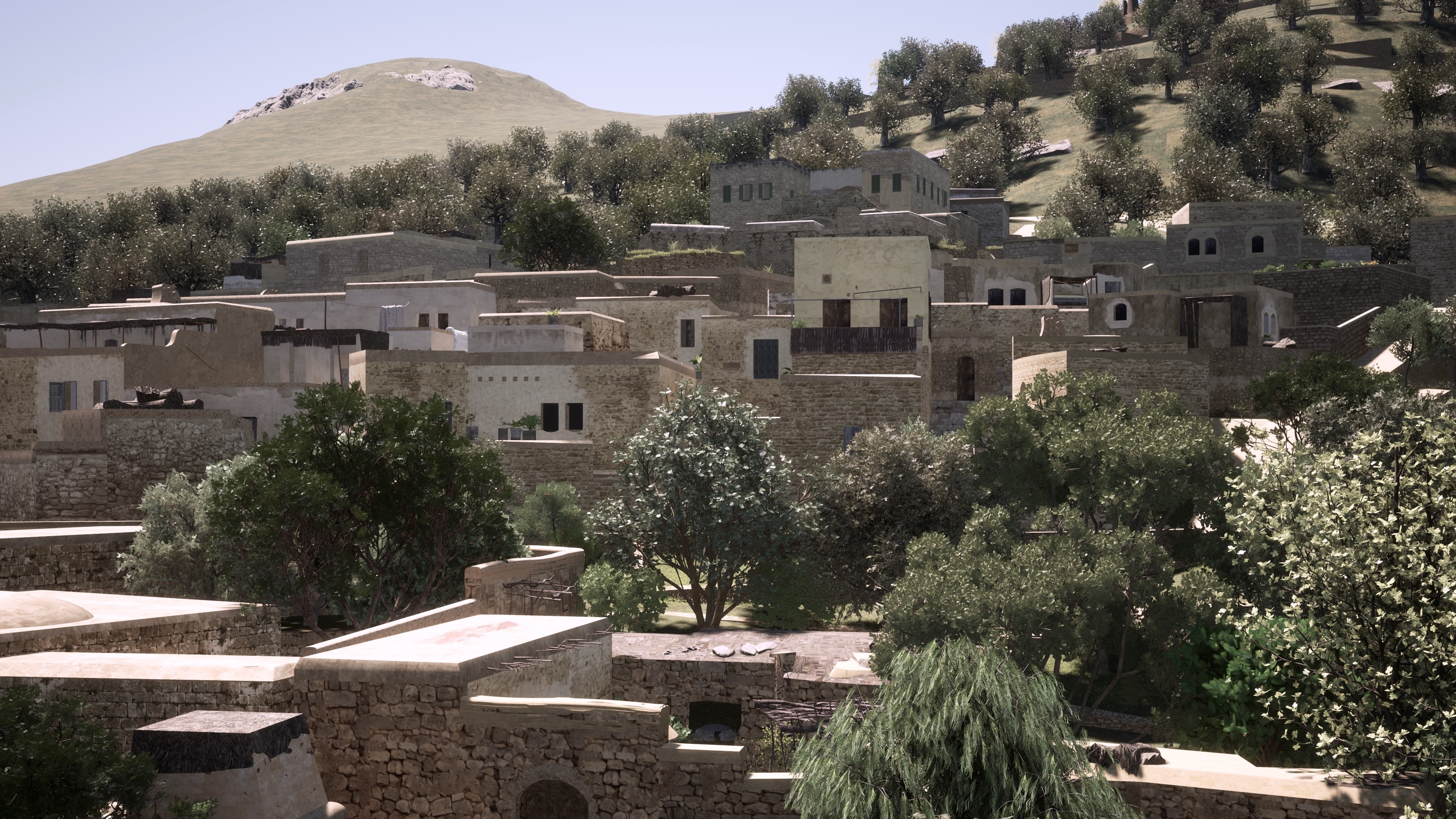
Immersive Structural Realignment. The synchronized 3D workspace viewport. By wrapping historical surveying arrays over dynamic spatial assets, the lost domestic architectures are systematically mapped back onto their exact geographical coordinates.
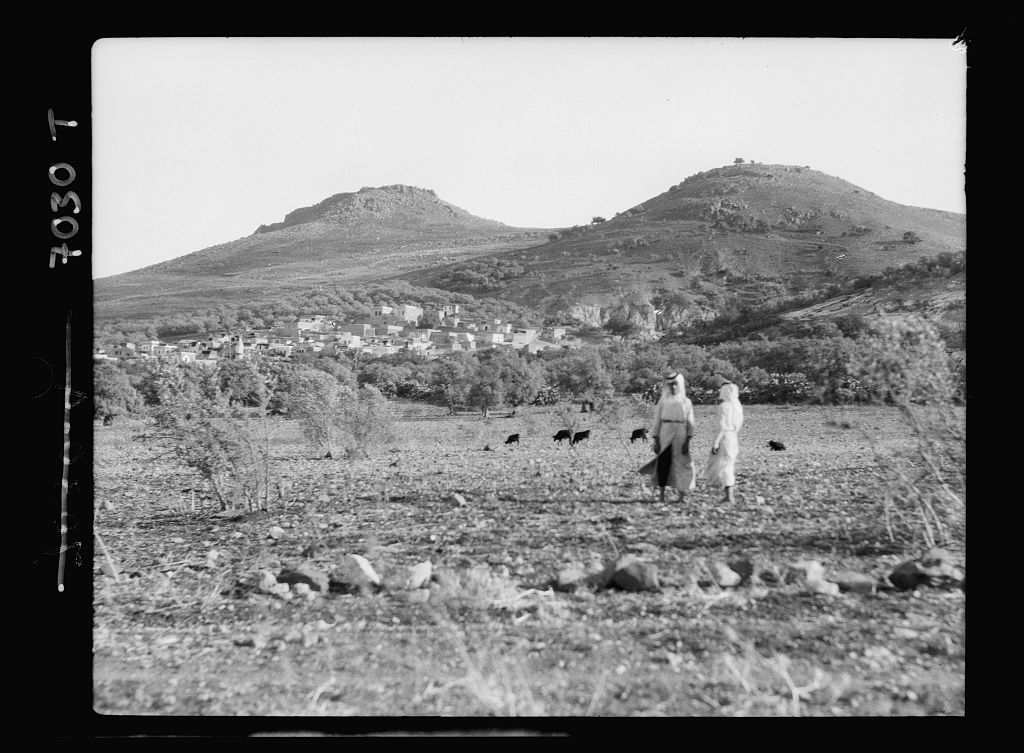
The Topography of Hittin
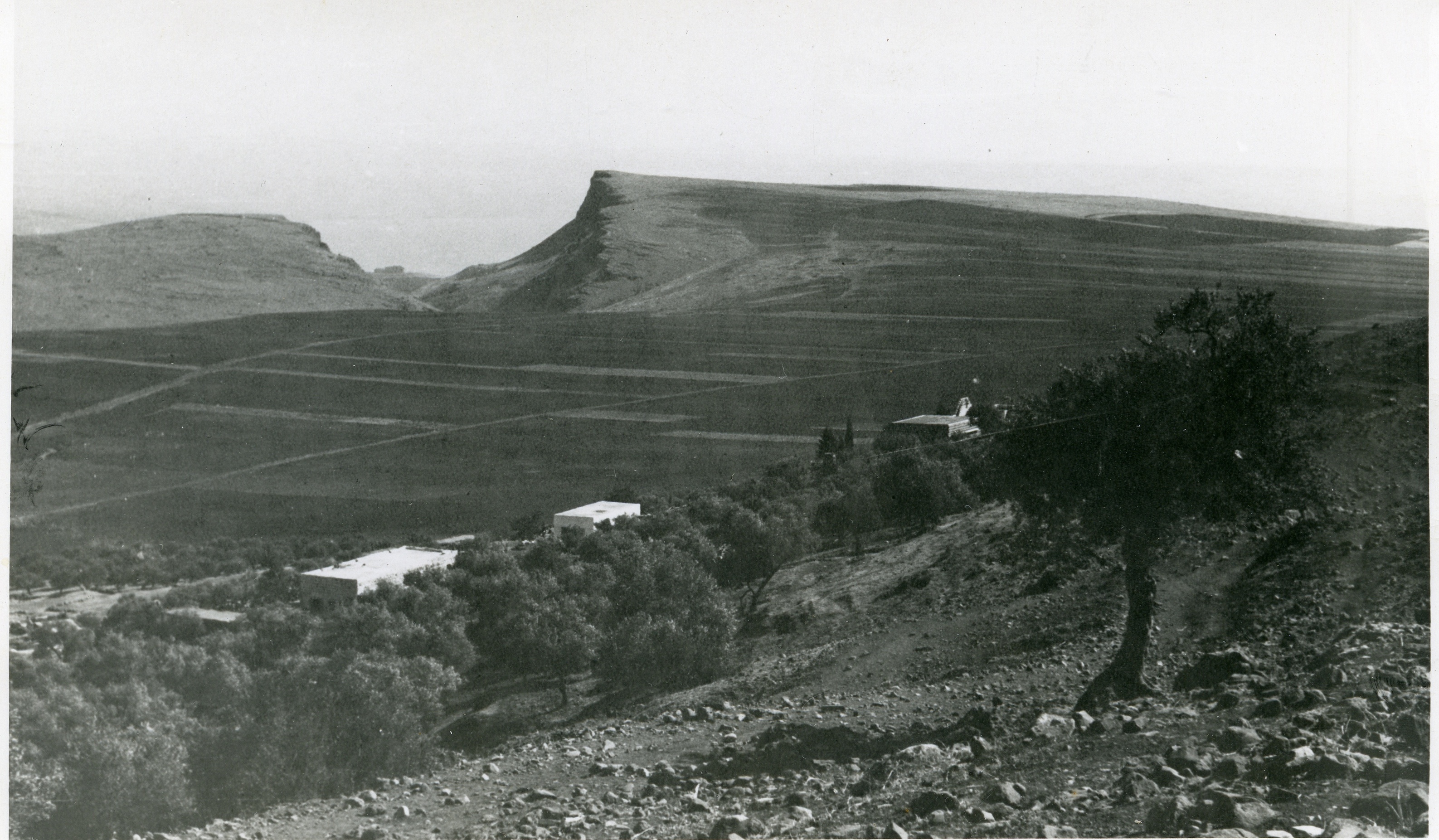
Located 8 kilometers west of Tiberias, Hittin was built upon a small wadi bed at the northern foot of the iconic, double-peaked volcanic hill known as the Horns of Hittin. This rugged landscape was not merely a backdrop; it was a commanding, strategic hub that dictated the entire architectural and military history of the settlement.
By dominating the Plain of Hittin, the village sat at a critical geographic junction. The plain opened onto the coastal lowlands of Lake Tiberias to the east and connected directly to the plains of lower Galilee via western mountain passes. These natural choke points and passages served as vital routes for historic commercial caravans, regional pilgrimage, and sweeping geopolitical movements across northern Palestine.
The Defense of the Pass
The war reached the area on June 9, 1948, when a Zionist armored assault on the neighboring sister village of Lubya was successfully repulsed. As the attacking column retreated eastward toward Tiberias, Hittin’s local militiamen opened fire from their elevated vantage points, successfully compounding the retreat before returning to the village core.
Shortly thereafter, sentries stationed at high-altitude lookout posts spotted an incoming armored and infantry column directly approaching the village pass. Outnumbered and facing acute ammunition depletion, the remaining defenders held their ground, engaging the military forces in an intensive four-hour siege that temporarily stalled the offensive.
During the second major offensive in mid-July (Operation Dekel), Israeli units completely encircled the mountain pass following the fall of Nazareth. The village was occupied, and a strict military perimeter was established just as a secondary UN truce went into effect.
Displaced families who attempted to cross back into the village over the following days to salvage possessions were systematically fired upon. Many waited on the extreme mountain outskirts for up to a month, looking down at their homes and hoping for safe passage. Denied re-entry, the vast majority of the population was forced into permanent exile across the northern border into Lebanon.
Agrarian Colonial Overlays
While early Jewish colonial settlements like Mitzpa (1908) and Kefar Chittim (1936) were established nearby, they remained completely outside the legal boundaries of the village. Following the 1948 depopulation, the state systematically partitioned the land.
Physical Traces & Ruins Today
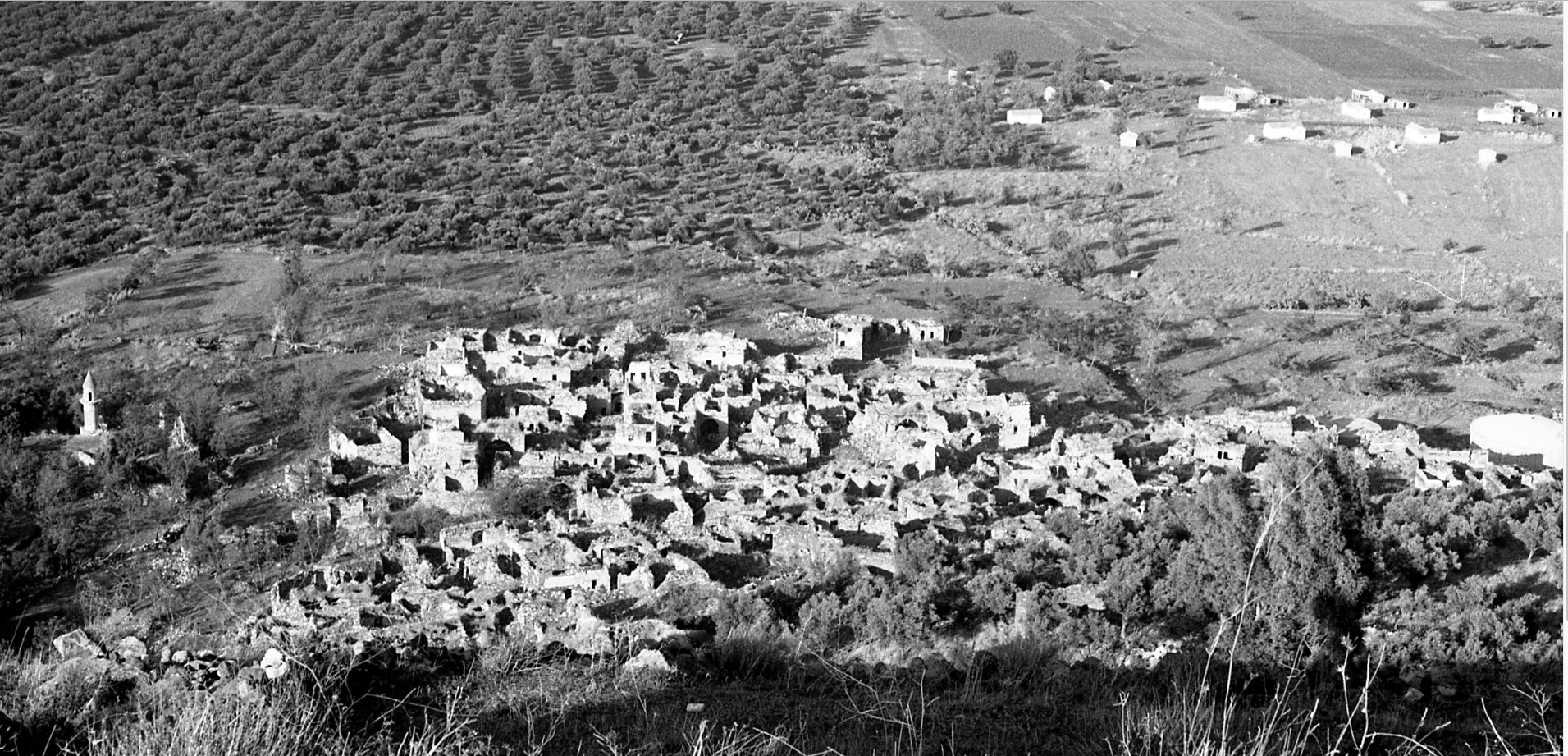
Today, the residential fabric of Hittin is largely gone, covered under heavy grass and scattered mounds of basalt stones. The agricultural plains are intensely cultivated by the surrounding settlements, while the steep mountain slopes have been restricted to cattle grazing.
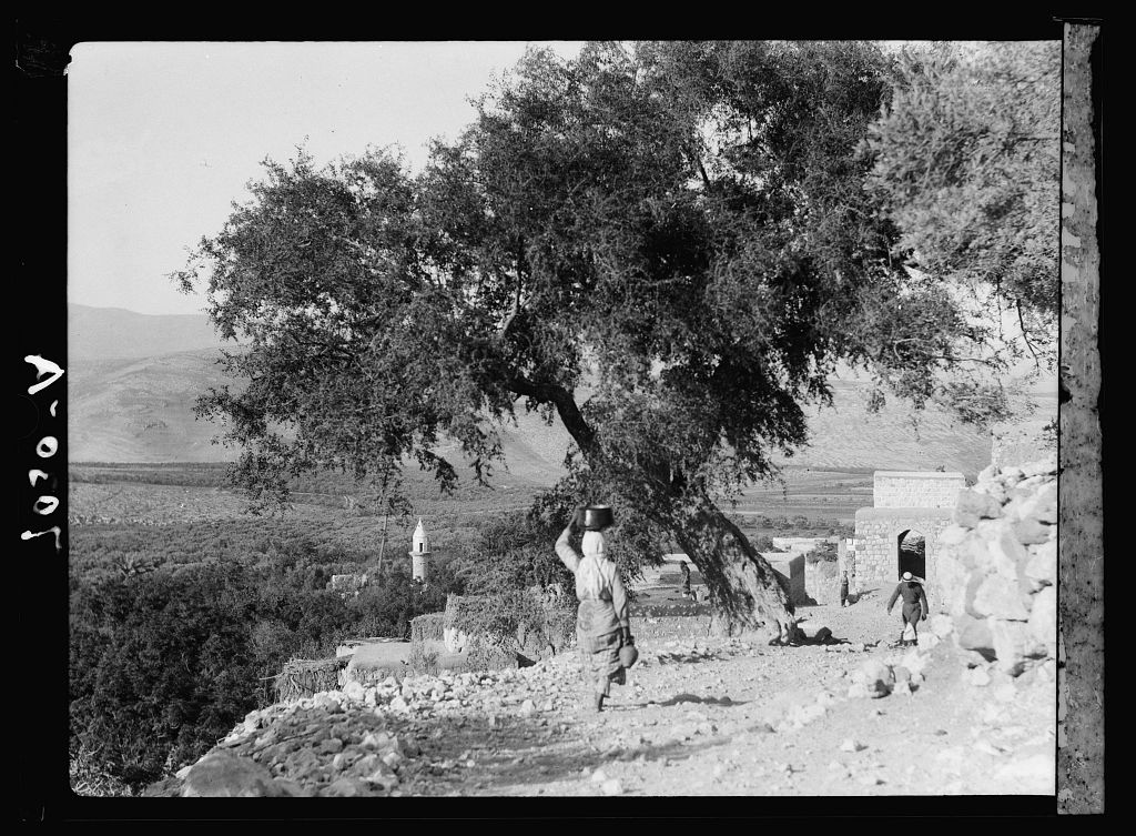
- The Village Mosque: Stands deserted as an isolated spatial anchor; its stone minaret remains fully intact, though its structural internal arches are crumbling.
- Natural Flora Markers: Thick growths of wild cacti, fig, mulberry, and tall eucalyptus trees trace the exact soil contours where stone houses once stood.
- Al-Nabi Shu’ayb: The ancient sacred Druze sanctuary on the periphery remains active, surviving the complete erasure of the village center.

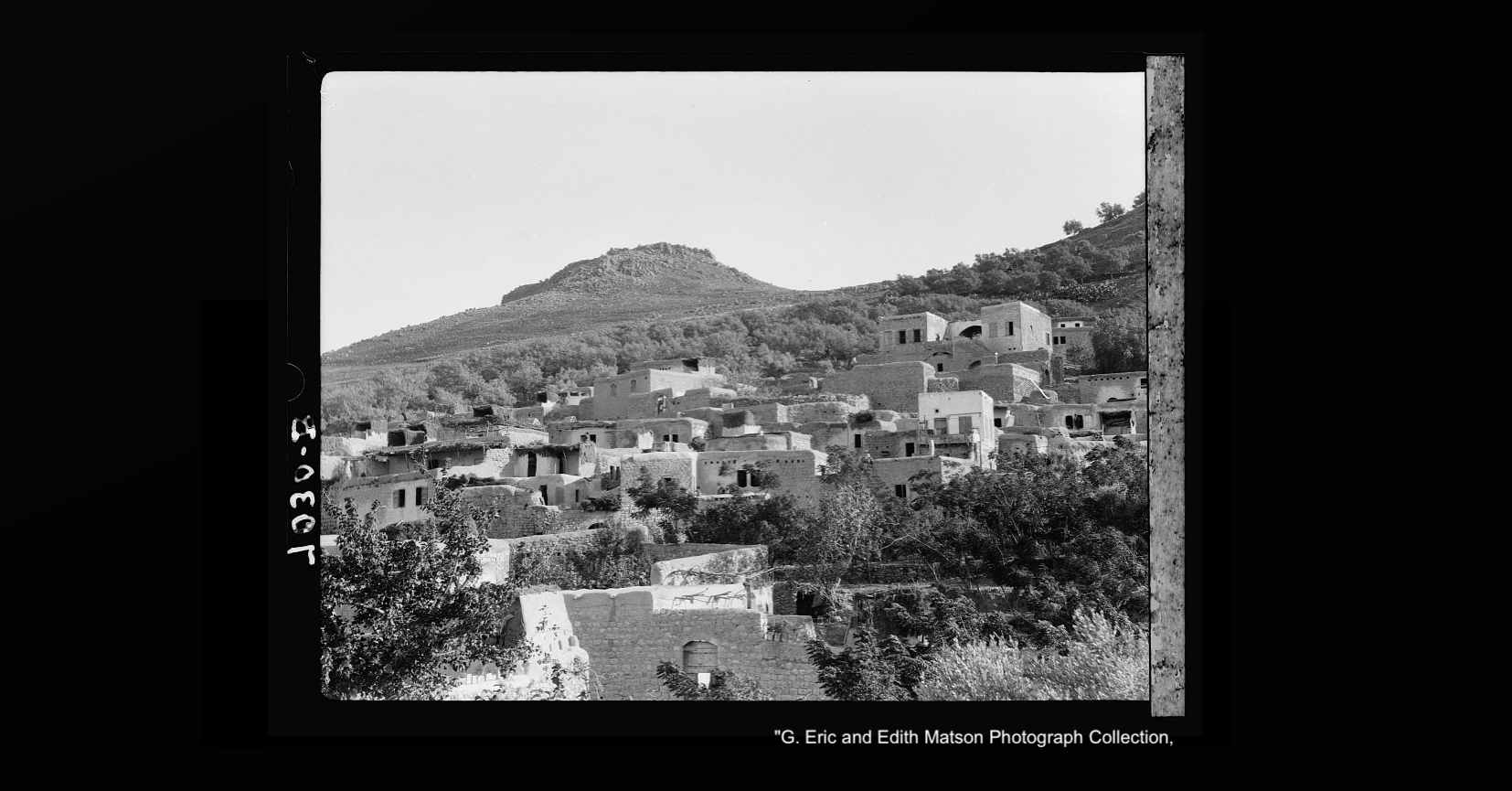
can i use the photo of the village on the hill in a poster about the anniversary of the nakba?
The main theme in the poster will be an old key with the Palestinian flag
LikeLike
Hi,
Thanks for your interest. Yes you can use a screenshot from the VR movie for the village and I would greatly appreciate if you wouldn’t mind crediting me in your poster.
Best Regards
LikeLike