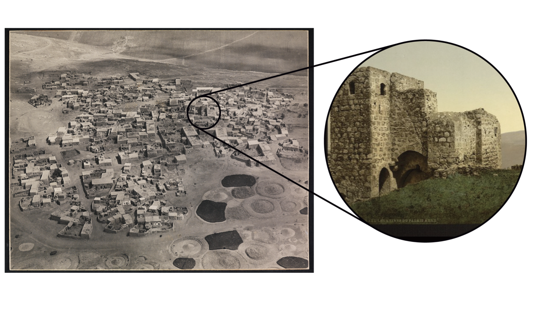
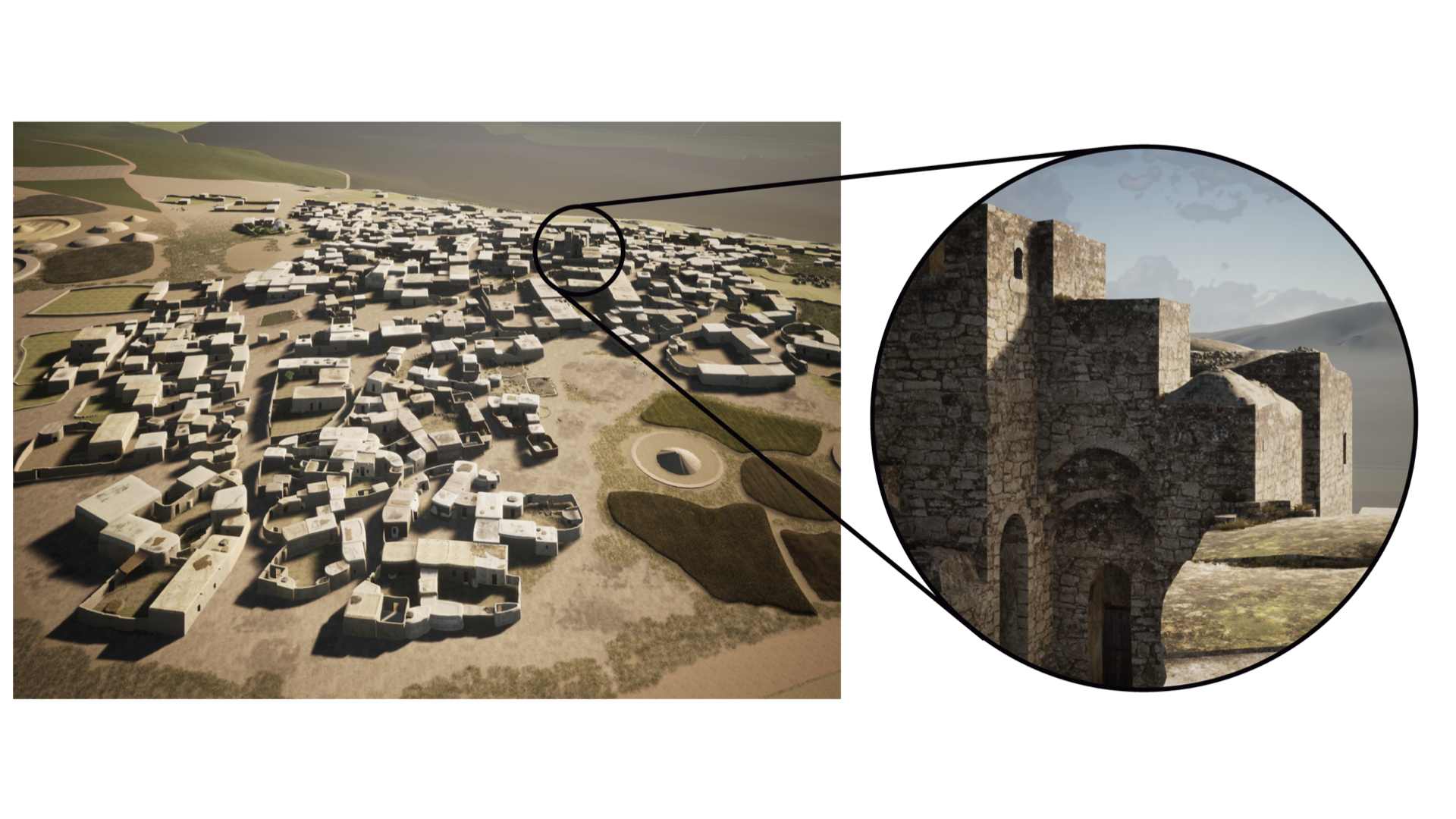
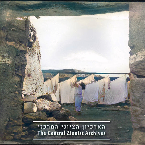
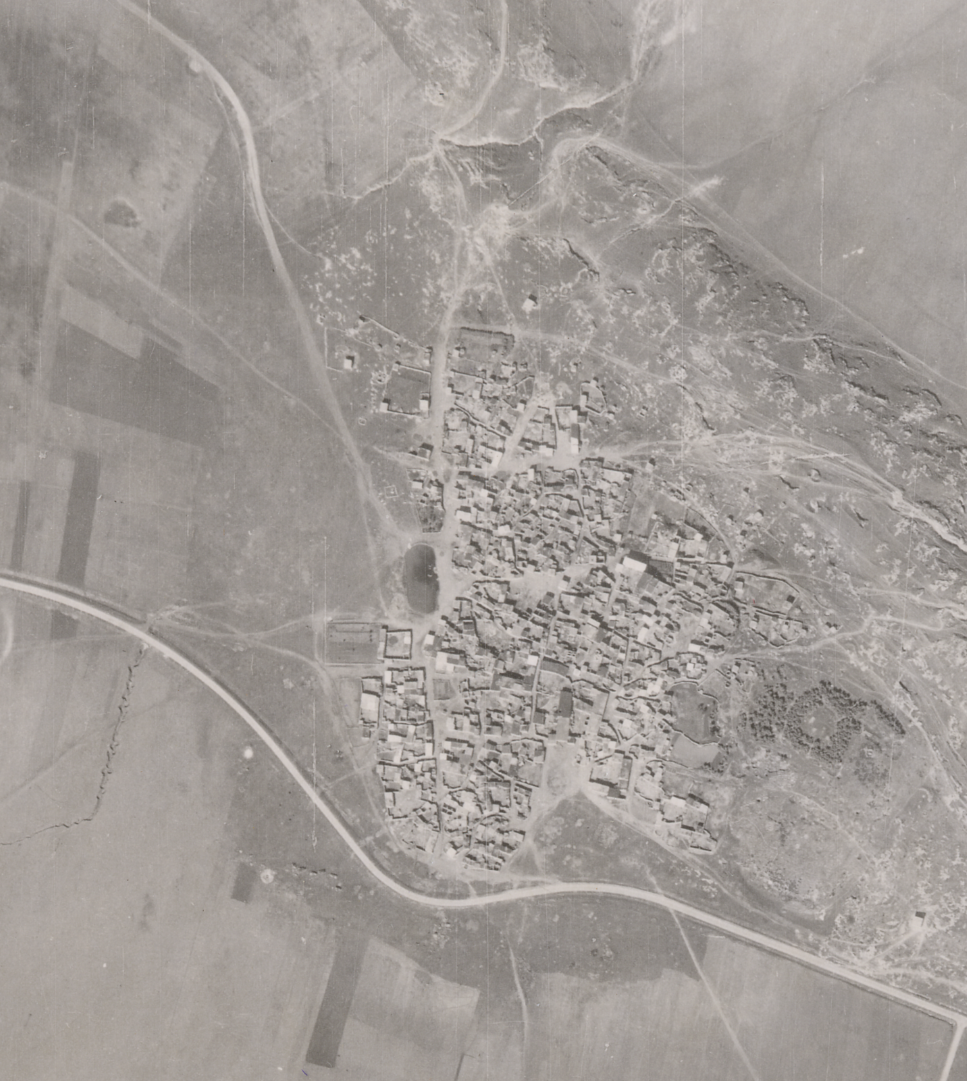
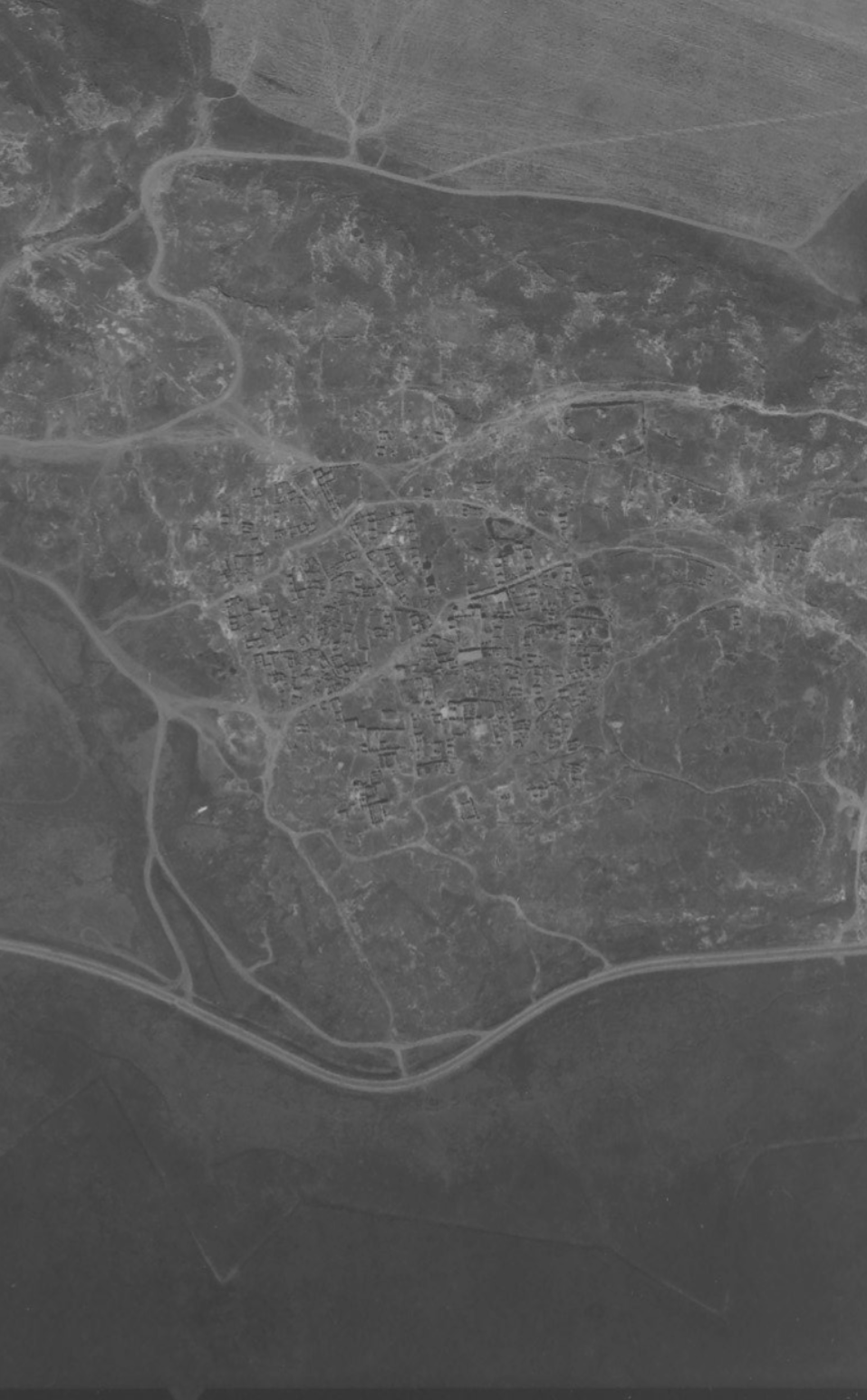
Zir’in

Village Profile No. 03 // Jenin District
Zir’in: The Sentinel of the Valley
A historical, visual, and spatial analysis of a strategic community perched on the northern spurs of the Faqqu’a Mountains, tracing its defensive significance, its targeted demolition in 1948, and the digital reclamation of its physical fabric.
Zir'in Historical Archival Topography Map
Archival Matrix
Zir'in 3D Spatial Reconstruction
Spatial Model
Figure 3.1: Comparative Spatial Dialectic. Structural transition mapping from traditional archival infrastructure coordinates (left) to generative immersive 3D topography models (right). Forensic Method
01 // Spatial Geography

The Strategic Topography

The village of Zir’in was situated on a small plateau—a distinct spur projecting dynamically from the Faqqu’a Mountains to the south, located 11 kilometers north of Jenin. Positioned in a commanding defensive posture, Zir’in overlooked the expansive plains of the Afula and Baysan valleys, granting it immense logistical and tactical importance in controlling regional circulation routes.

02 // Chronology of War

The Expulsion and Demolition

By March 1948, aggressive tactical campaigns targeted the village. Following heavy mortar bombardments to soften its outer perimeters, the village was captured on May 28, 1948, by the Thirteenth Battalion of the Golani Brigade. Repeated counter-offensives launched throughout July attempted to break through the lines, but final armistice boundaries were ultimately drawn just south of the site.

03 // Forensic Landscape

The Fragmented Remains

Today, the settlement of Yizre’el occupies the northwestern footprint of the traditional village boundaries. Only a single, dilapidated structure remains standing on the site. The landscape is heavily overgrown with wild vegetation, interspersed with prominent, artificial piles of cleared stones—functioning as botanical and physical markers of an erased domestic reality.

“With the capture of Zir’in, most of the village’s houses must be destroyed while [some houses] should be left intact for accommodation and defense.”

— Palmach Headquarters Military Operational Order, April 19, 1948
Visual Evidence
Forensic Archival Database
Click to Explore Archive
Zir'in Archival Photo Record 07
Zir'in Archival Photo Record 08
Zir'in Archival Photo Record 05
Zir'in Archival Photo Record 10
Zir'in Archival Photo Record 04
Zir'in Archival Photo Record 01
Spatial Verification
Geographical Mapping
☉ Satellite Topography (Tel Yizreel)
➔ Reconstructed Virtual Return Journey
Immersive Exploration
Virtual Journeys to Zir’in
Zir’in Community Space Portal 01

Reconstructing the core gathering locus of the historic village. This environment maps out the structural configuration of Zir’in’s public sphere where social gathering and daily routines intersected.

Spatial Orientation Central Community Node
The Path Towards the Tower Portal 02

Tracing the route toward the village’s old Castle and tower. This path captures the strategic vantage postures overlooking the expansive surrounding lowlands.

Spatial Orientation The Castle of Zirin
Spatial Memory Archive
VRJ Palestine © 2026
Seasonal Fragments
The village moved through harvest, wind, grazing paths, and seasonal festivals.
Agricultural
Seasonal Cycle
Children and seasonal carnival
Children gathered around the seasonal carnival while passing through Zirin heading to Nabi Musa. Seasonal movement structured everyday life through grazing routes, harvest cycles, water access, and communal agricultural rhythms surrounding Zirin.
Oral Fragment Archive
Recorded Agricultural Memory
The harvest.
Seasonal movement structured everyday life through grazing routes, harvest cycles, water access, and communal agricultural rhythms surrounding Zirin.
Spatial Memory Fragment
c. 1930–1948
Contemporary Geography
The village no longer appears on contemporary maps.
Demolition of Zirin, photographed in 1949 following the expulsion of the village population during the Nakba.
Archival Demolition Record
Zirin, 1949
Remaining village structures photographed during the destruction process following the depopulation of Zirin.
Spatial Erasure Documentation
Post-Depopulation Archive
Zir'in 1945 Aerial Baseline Survey
Pre-Expulsion Spatial Baseline (1945). High-altitude aerial documentation showing the intact urban fabric, residential roof alignments, and deep geographic integration of Zir’in prior to the 1948 depopulation and systemic landscape alteration.
Historical Air Survey
Survey Year: 1945
Zir'in 1952 Aerial Survey Post-Demolition
Aerial Survey Matrix (1952). High-altitude reconnaissance capture (Flight 071, Photo 1739) registering the absolute physical footprint of Zir’in three years after systematic landscape demolition. The foundations of cleared structures remain visible as light traces across the topography.
Reconnaissance Flight 071
Survey Year: 1952
Route of Displacement
The people of Zir’in survived the destruction of the village, but not their displacement.
During the 1948 war, the people of Zir’in fled southward toward Palestinian-held areas. Former residents dispersed throughout the city of Jenin and neighboring villages, particularly Qabatiya and Arraba. The largest concentration settled on the outskirts of Qabatiya, where many families remained in the immediate aftermath of displacement.

Following the establishment of the Jenin Refugee Camp in 1950, many refugees who had initially settled in surrounding villages relocated to the camp. A significant number of Zir’in’s former residents and their descendants continue to live there today.

According to a 2008 UNRWA report, the number of registered refugees from Zir’in was approximately 9,845 people. They were distributed across the following areas: Syria: Al-Ayns, Yarmouk, and Takiyya. Jordan: Marka Camp, Zarqa (Prince Hassan District), Russeifa, Sakhra, Amman, Baqa’a Camp, Sweileh, Husn Camp, Souf Camp, Irbid, and Mazdar. West Bank: Jenin Refugee Camp, Nur Shams Refugee Camp, Nablus, Al-Yamun, Silat al-Harithiya, Qabatiya, Jaba’, Al-Arroub Refugee Camp, Jiftlik, Ya’bad, Tulkarm, Ramallah, Al-Far’a Refugee Camp, and Deir Ghassaneh.
1948–1950
Jenin · Qabatiya · Arraba · Jenin Refugee Camp
Village Registry
Administrative record of Zir’in prior to its depopulation.
Population
1,420
Land Area
23,920 dunams
District
Jenin
Agriculture
Wheat & Olives
Depopulated
May 1948
Coordinates
32°35′N
Occupations and Trades
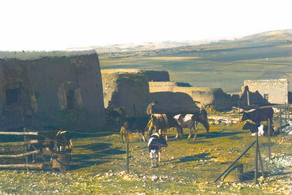
Zir’in’s economy was primarily based on agriculture, particularly the production of wheat and sesame, which often generated surpluses traded through barter. The village supported a variety of occupations, including merchants, shopkeepers, butchers, carpenters, barbers, agricultural laborers, field guards, government employees, and practitioners of traditional medicine. Local commerce was centered around village shops and the trade of agricultural products. Some residents worked for wages in Haifa’s port, petroleum facilities, and railway system, while others held positions in public works or government services. Landless villagers often worked as hired farm laborers, receiving payment through crop-sharing or barter arrangements.

Overall, the village’s occupational life reflected a largely agricultural society supported by a network of skilled trades, local commerce, and traditional services.
Data Prior to 1948
Families of Zir’in
The families of Zir’in included the Haj Ibrahim, Haj Jabr, Shalabi, al-Fayid, Rahal, Subaitan, al-Fallah, al-Atiq, Abu Atiya, Abu Sariya, Matahin, al-Maqsaqs, Gharib, al-Hanoun, al-Nashrati, al-Amouri, al-Zuraiqi, al-Qaram, Lahlouh, Abu Salmi, Abu Laban, al-Qadam, al-Kalash, al-Hathnawi, Huweil, al-Asmar, al-Shahrour, al-Qawsini, Abu Na’sa, al-Tubasi, Abu Dhiba, and Abu al-Dayri families.

Together, these families formed the social fabric of the village, with some being large landowning families and others consisting of farming households and smaller family groups. The Abd al-Hadi family, although not originally from Zir’in, owned a significant proportion of the village’s agricultural lands and was among the major landholders associated with the area.
Compiled from Mandate-era records, oral testimony, and archival documentation preserved by descendants and research institutions including the Plands Institution.

Leave a comment