
Fragments of reconstructed Palestinian environments rebuilt through oral testimony, spatial memory, and fragmented archival traces.
Immersive Reality
Employing 3D environmental modeling and virtual reality frameworks to document and restore geographical history.
Spatial Regimes
Analyzing structural layouts, landscape architecture, and internal social engineering models.
Forensic Humanities
Cross-referencing historical archives and data structures to counter systemic cultural erasure.
Featured Investigations [02]
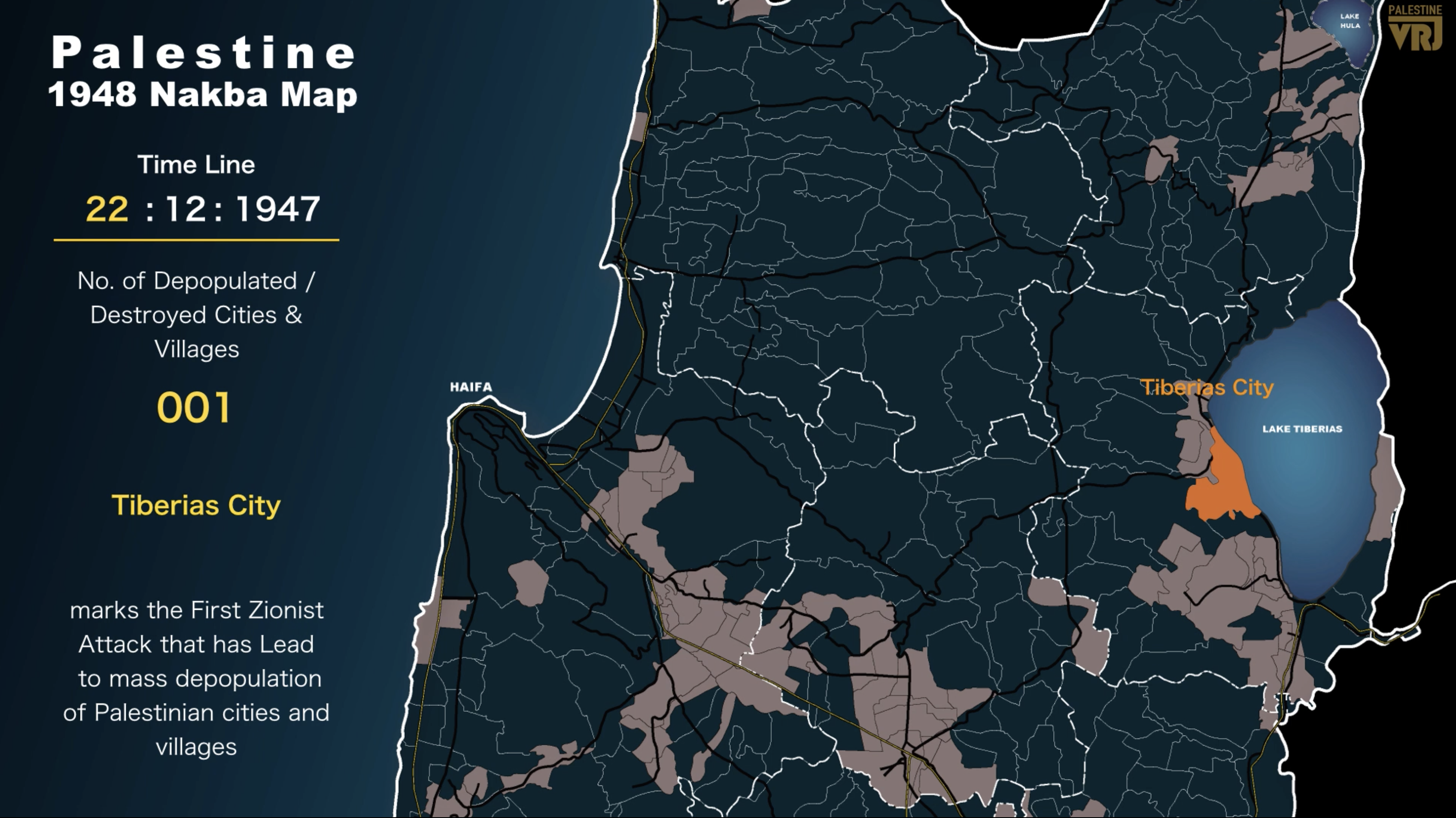
The Nakba Animated Map
A spatial archive tracing the depopulation of Palestinian cities and villages during the 1948 Nakba through historical maps, timelines, and geographic analysis.
Enter Timeline MapThe Story of Abubaker
A reconstruction of displacement through personal testimony, tracing one family’s journey from Beit Daras to Gaza across generations of exile.
watch the story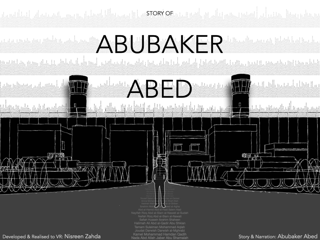
3D Spatial Reconstructions [04]
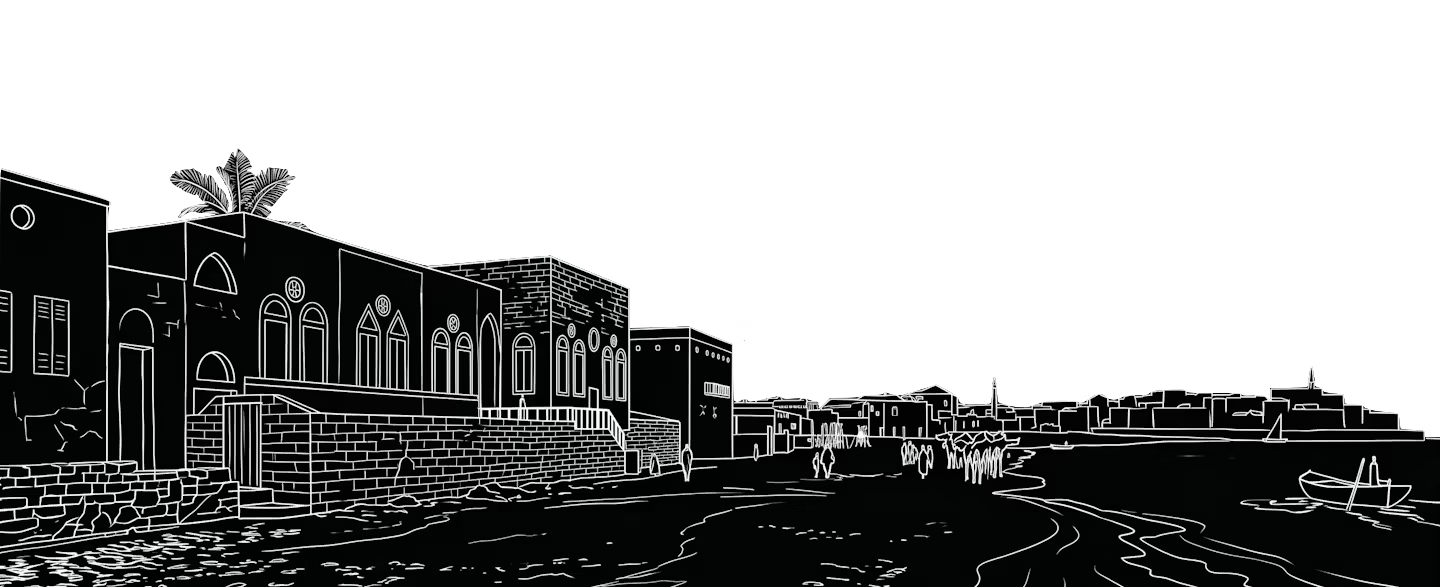
Jaffa Flashbacks
An urban-scale digital reconstruction mapping the historical fabric, quarters, and coastal architectural topography prior to 1948.
Enter Environment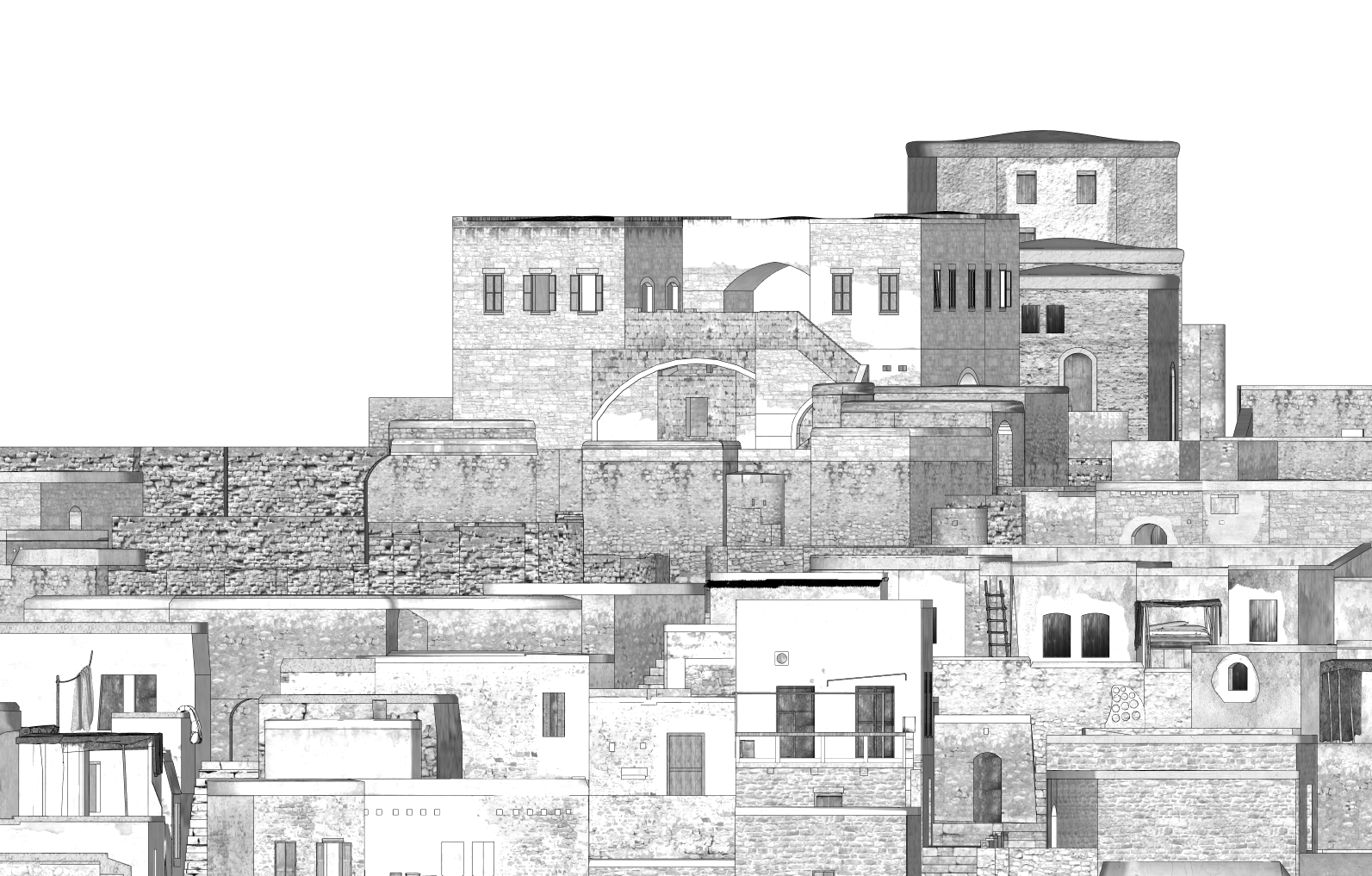
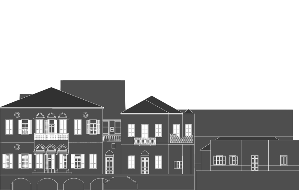
Hittin Remembered
A comprehensive digital recovery of the village fabric, modeling structural layouts and terrain data alongside surviving architectural ruins.
Enter Environment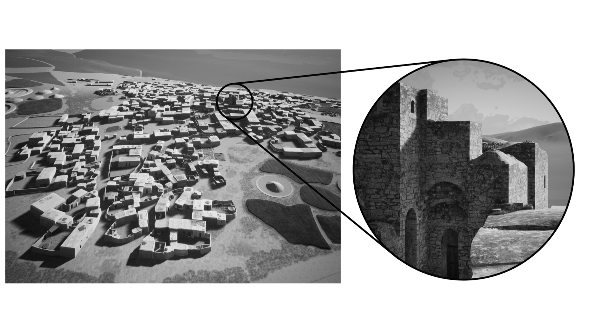
Zir’in…A Return Journey
Spatial reconstruction analyzing the village’s historic hilltop topography, agricultural landscape patterns, and structural footprints.
Enter Environment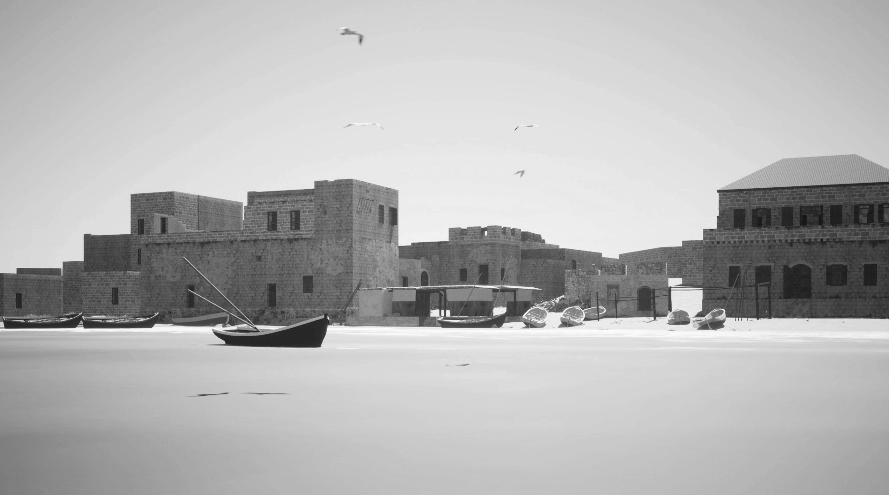
Tantura Reconstructed
Coastal forensic reconstruction cross-referencing aerial mapping data with oral histories to restore the erased maritime village grid.
Enter EnvironmentExplore Reconstructed Palestine
An interactive virtual reality environment reconstructing erased Palestinian spaces through spatial memory, oral testimony, and immersive exploration.
Enter VR Tour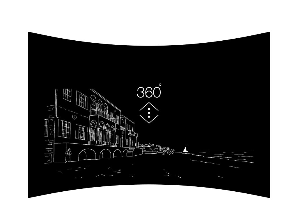
Other Projects [03]
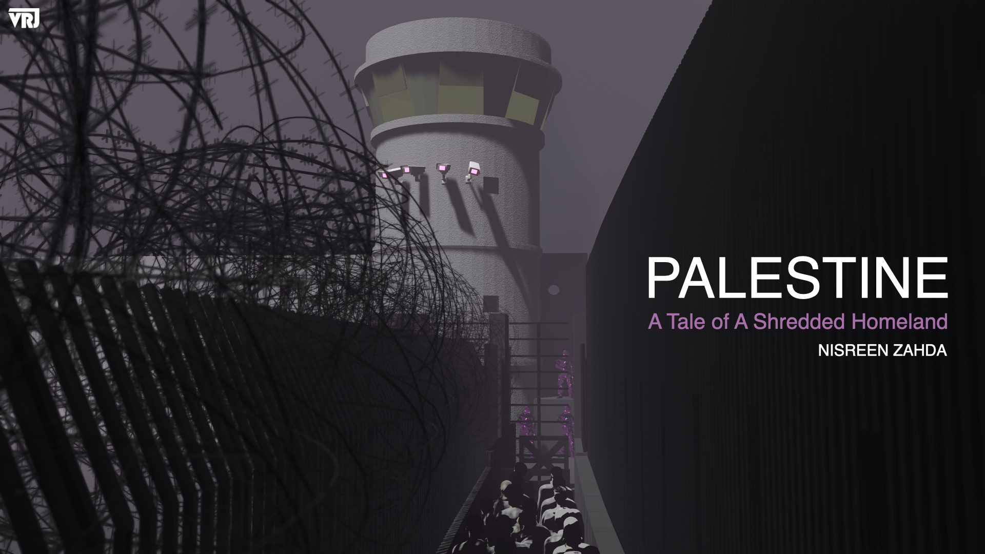
Palestine: A Tale of A Shredded Homeland
An animated tale depicting a nation exiled within its own homeland. Through line art, 3D graphics, and infographics, the short film captures a unified land fractured into besieged enclaves.
Watch The Work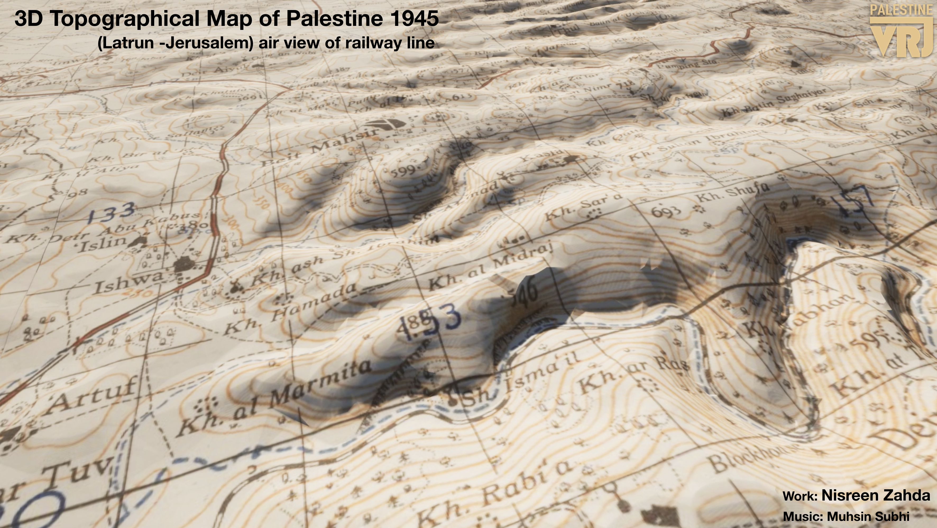
3D Topographical Map
A macro spatial processing model rebuilding the physical terrain of Palestine as charted in 1945, reconstructing accurate environmental contours and geographic baselines.
View Work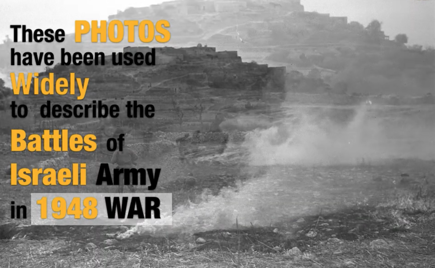
Debunking Staged Zionist Narratives
An archival forensic investigation examining widely circulated photographs used to represent the 1948 war, revealing how key media pieces were staged outside historical contexts.
View InvestigationVRJPalestine
An open-access digital humanities project dedicated to forensic spatial reconstructions, landscape architecture analysis, and the documentation of historic erasure.
// Navigation
// Collaboration
Seeking partners in architectural research, historical archiving, and immersive tech development.
