Reconstructed memories of pre-Nakba Jaffa rebuilt through oral testimony, fragmented archives, historical maps, and spatial reconstruction.
Before its depopulation in 1948, Jaffa was one of the most important Palestinian coastal cities, functioning as a cultural, commercial, and maritime center connected to the Mediterranean world. The reconstruction project attempts to recover fragmented spatial memory through digital environments and immersive reconstruction.
The virtual reconstruction of Jaffa overlapped periods of time between 1910s and 1948, with Jaffa in the spring of 1936 being the center of the reconstruction process.
The virtual reconstruction of Jaffa was carried out based on the available historical maps, pictures, and testimonies of those who were displaced from it.
Spatial Diachronic Study — Comparative Layout
Visualizing Landscape Transformation
Archival Fragment
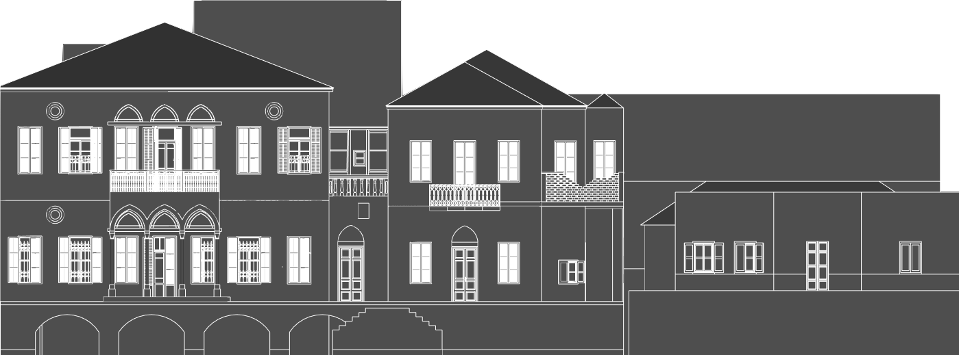
Pre-1948 Historical Landscape
3D baseline model mapping the dense coastal urban fabric and original topography of the Irshid beach community layout.
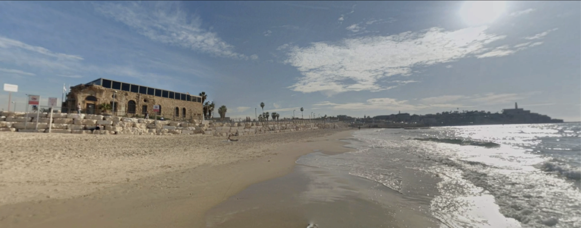
Contemporary State
Contemporary Spatial Realities
Corresponding perspective view indicating architectural erasures, layout restructuring, and modifications to the coastal zone environment.
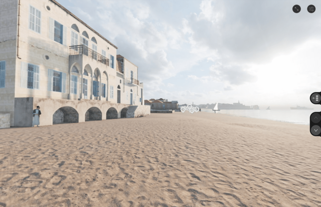
Interactive Portal
Explore the Immersive Street-View Mapping Environment
Having analyzed the macro-transformation above, you can now enter a fully spatialized reconstruction of Al-Manshiya. Walk through the street network, interact with historical data layers, and engage with verified testimonials mapped directly onto the terrain.
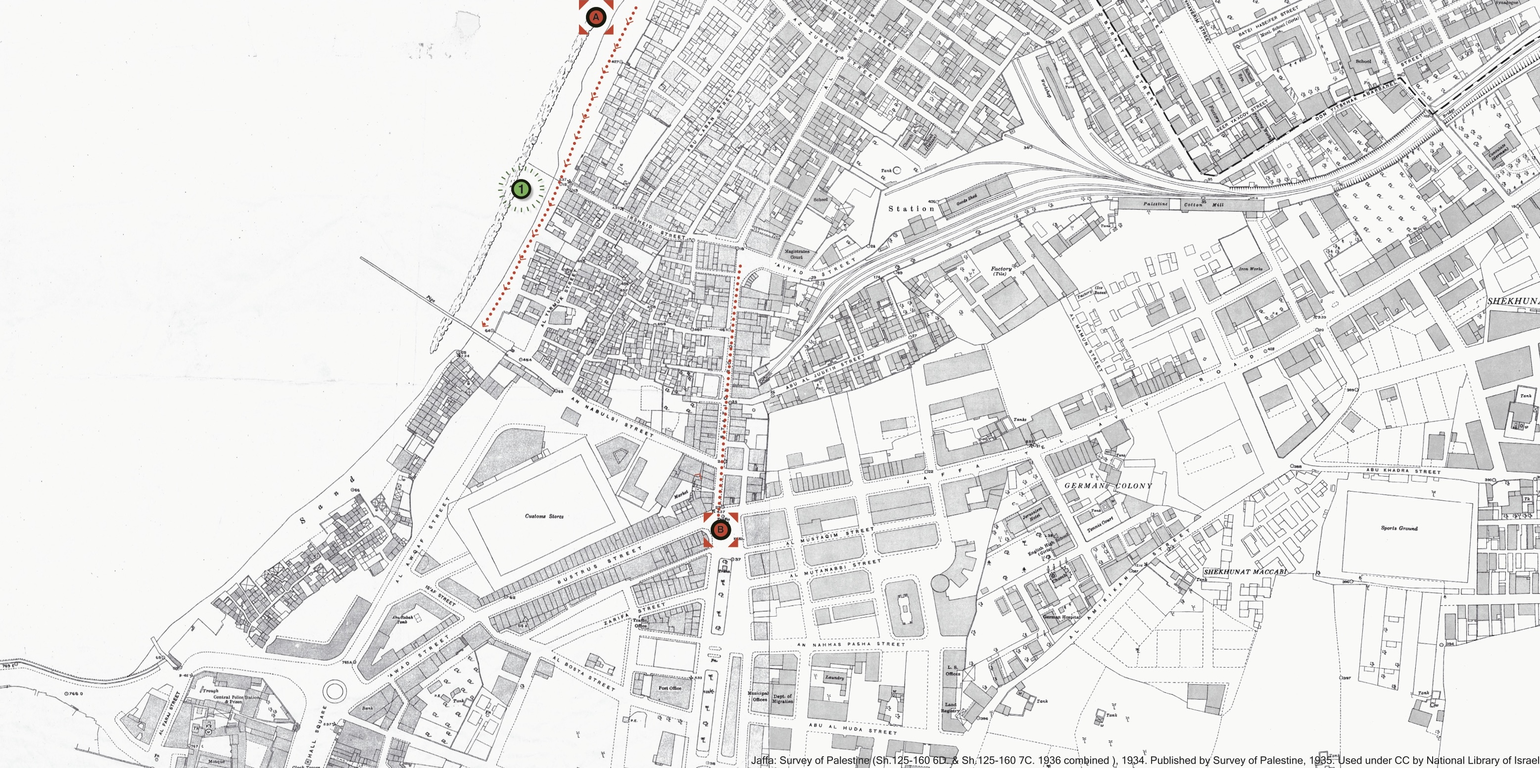
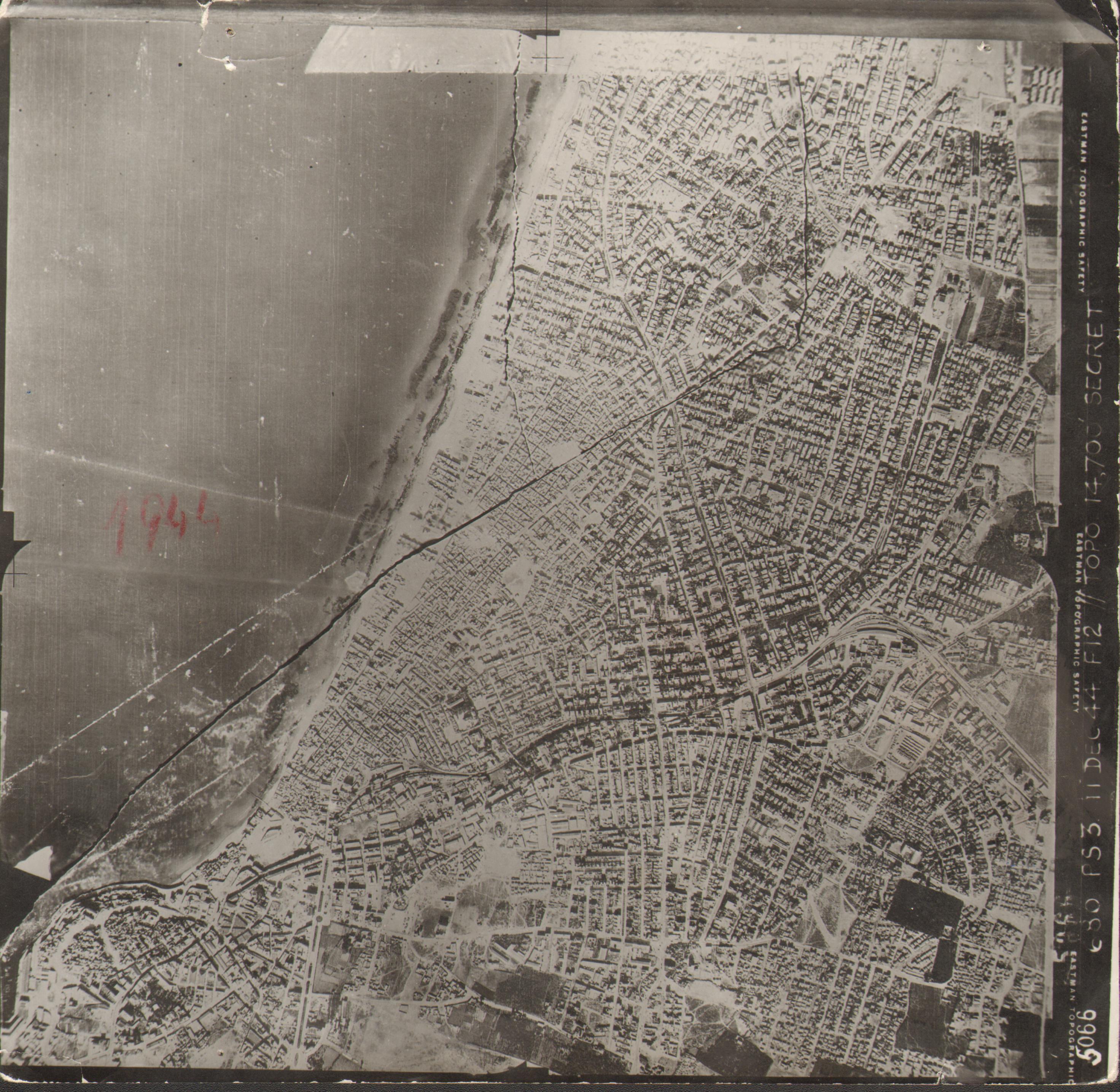
Survey map and Aerial photos documenting the spatial continuity of pre-1948 Jaffa and its coastal circulation routes.
32°03′N 34°45′E
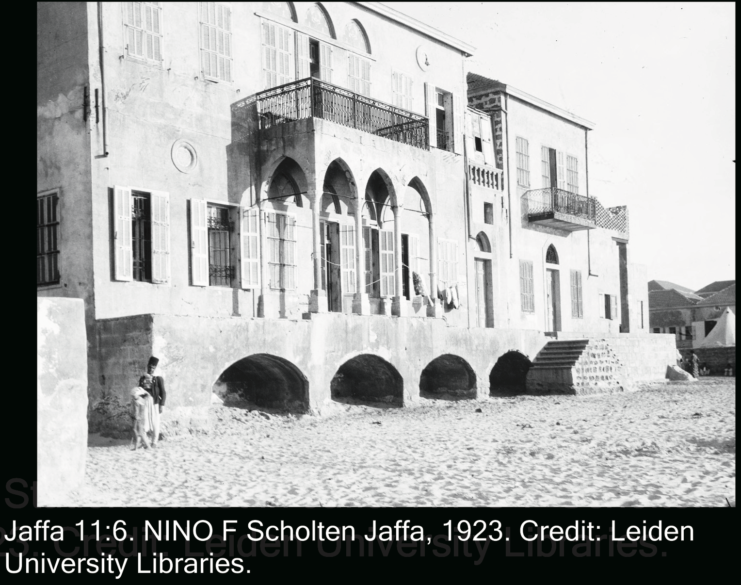
Urban Fragment
Fragmented architectural references used to reconstruct circulation routes and gathering spaces.
JAFFA DISTRICT ARCHIVE
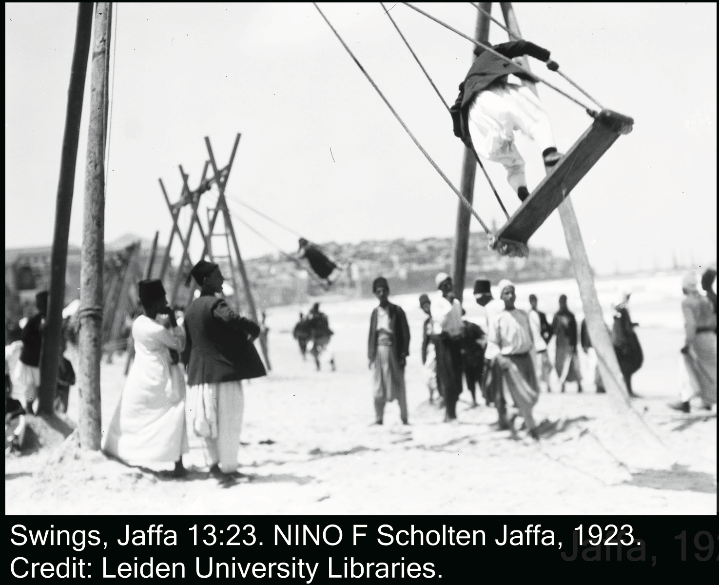
Witness Memory
Oral testimonies describing erased coastal life, movement, and communal space before displacement.
RECORDED MEMORY FRAGMENT
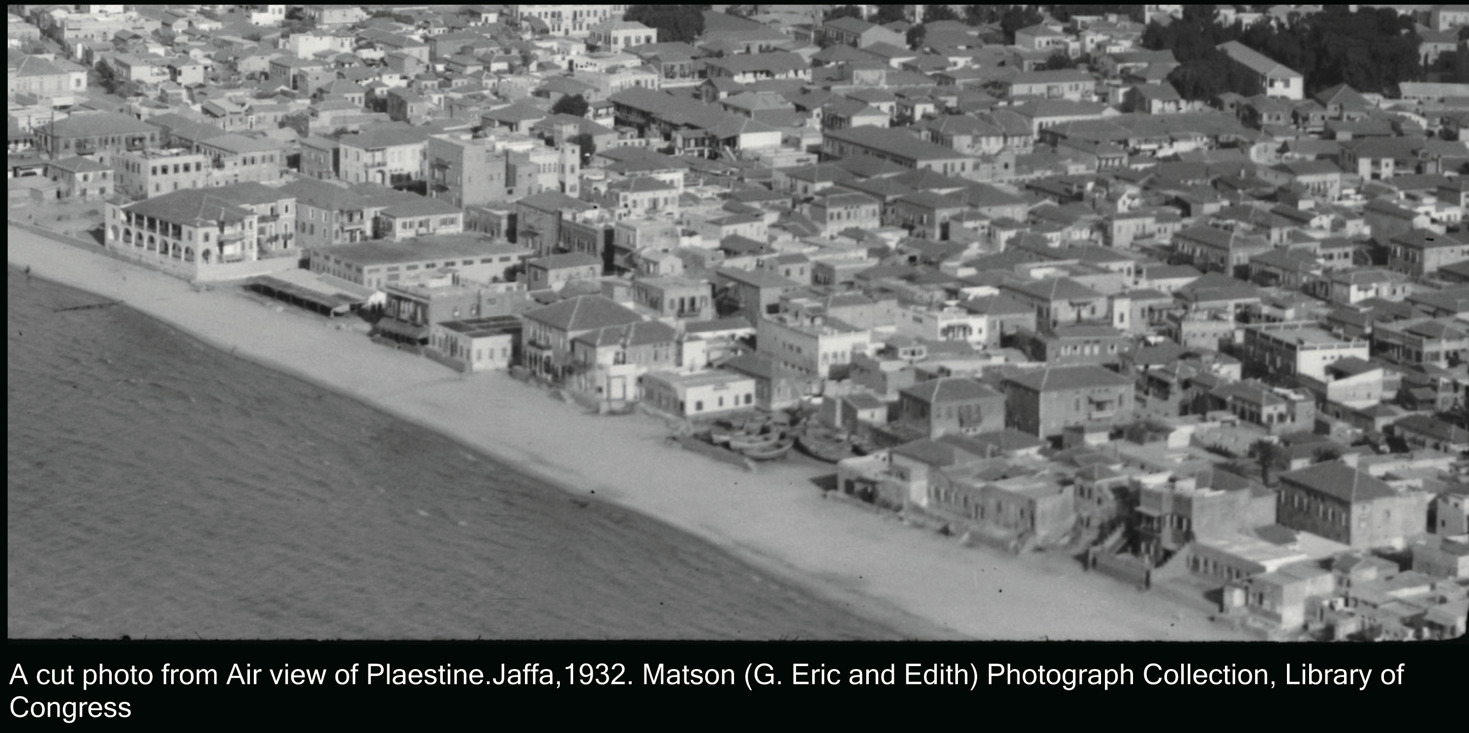
Aerial Fragment Archive
Tracing erased geography through survey maps, aerial imagery, and reconstructed space.
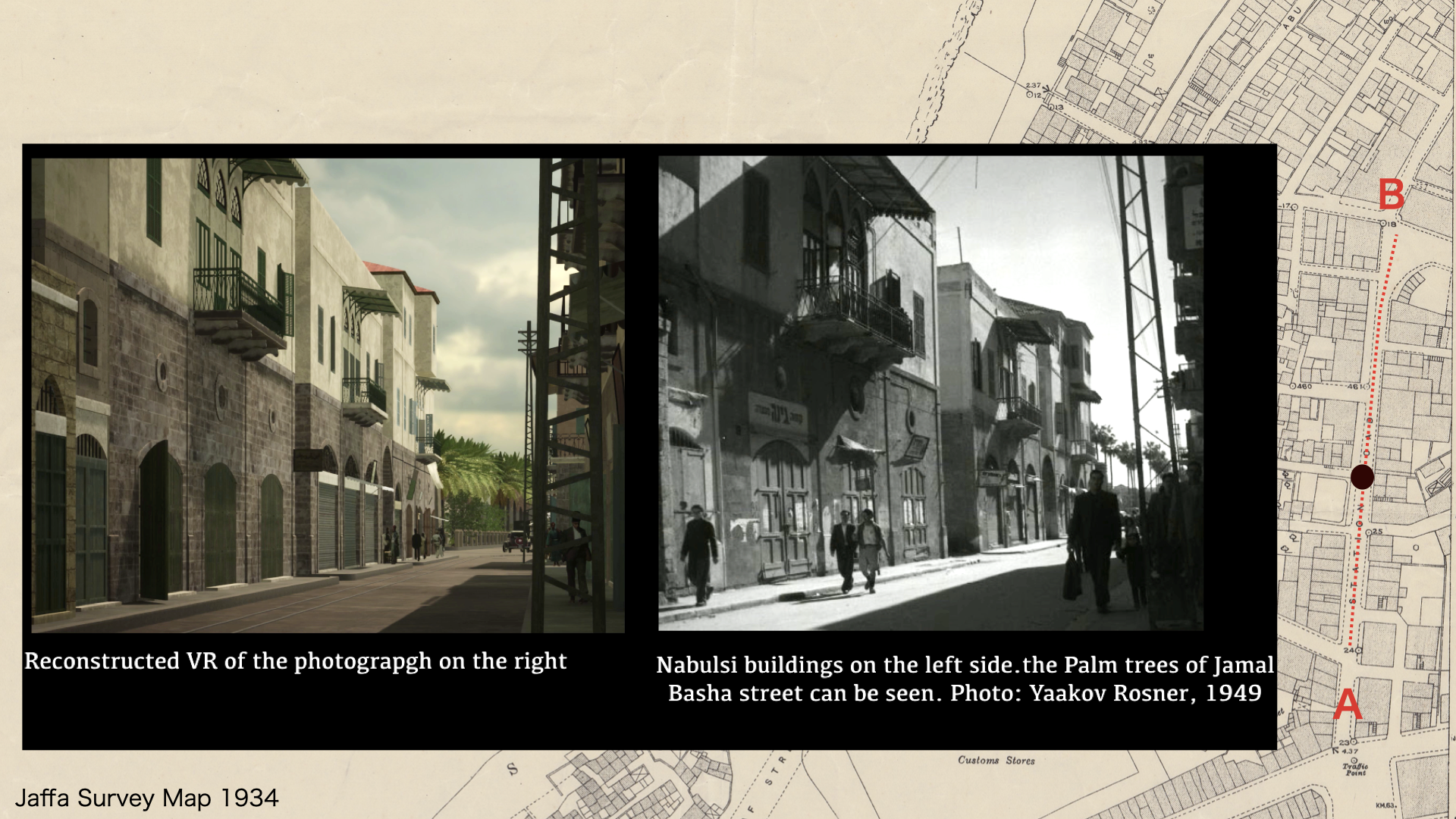
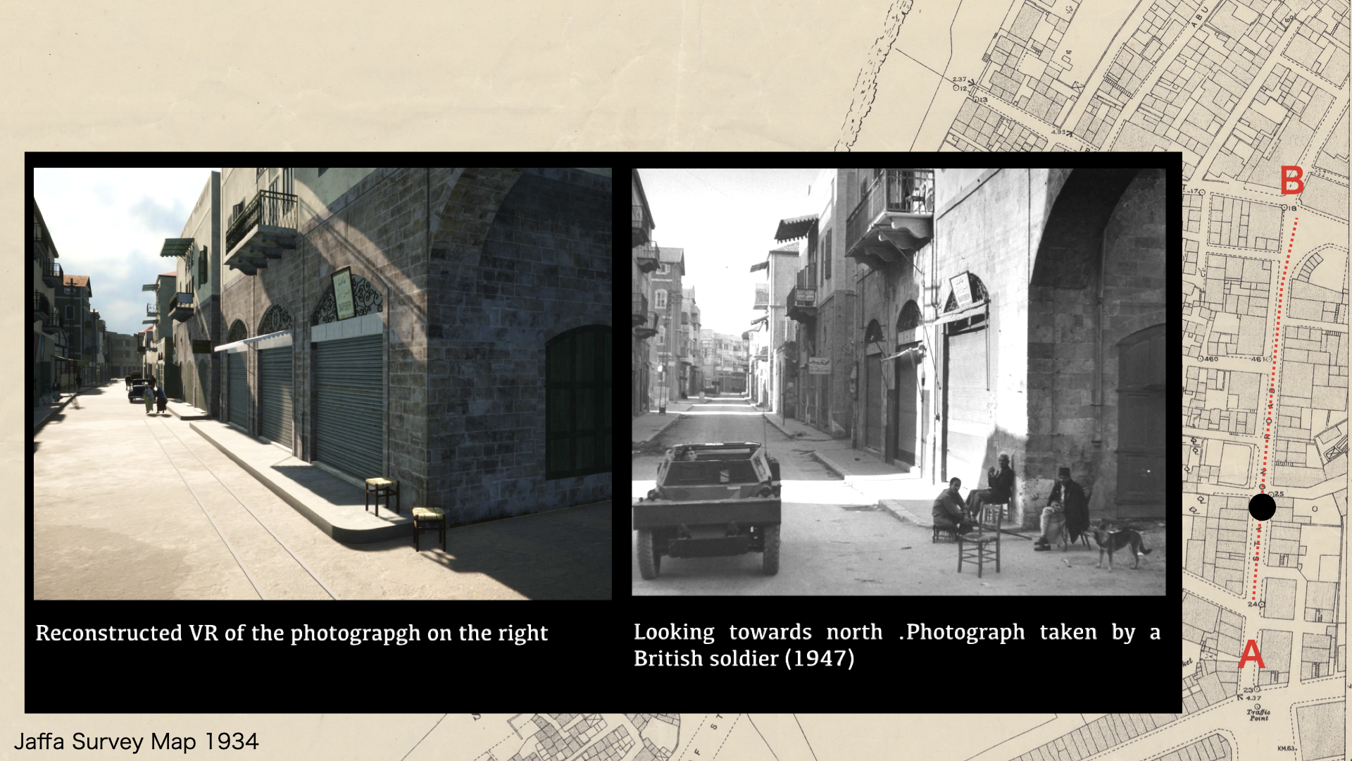
Survey map of Jaffa in 1934
Aerial photograph of Jaffa taken in 1944
Spatial Reconstruction Study 01
Reconstruction of Nabulsi Buildings at the beginning of Station Street.
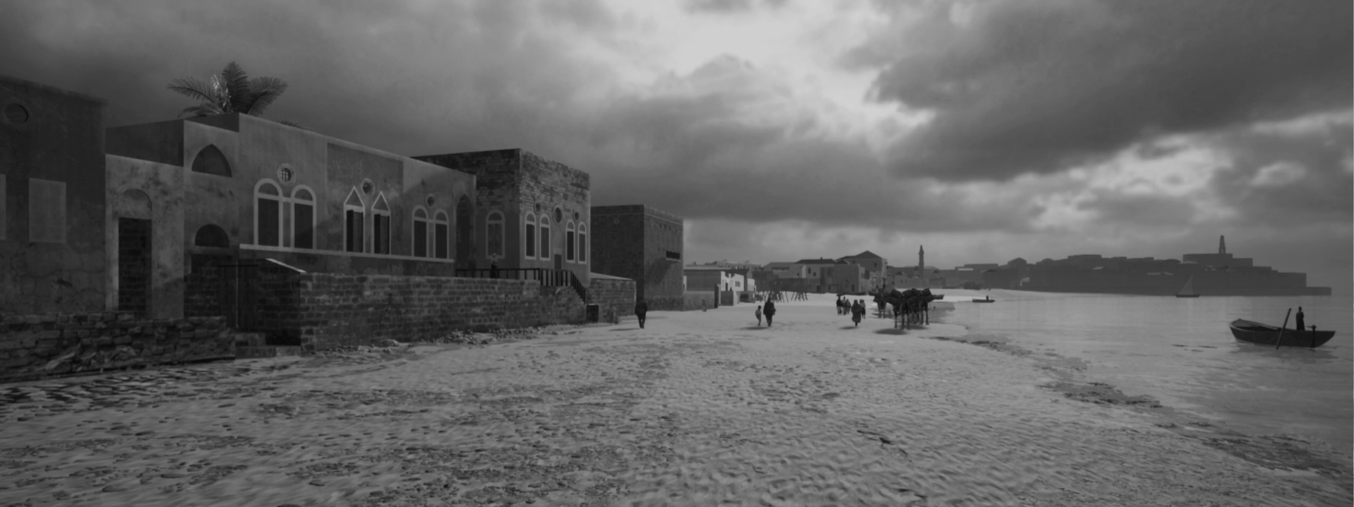
Spatial Reconstruction Study 02
Reconstructed VR Model of an archival photo revealing displaced circulation routes, erased architectural relationships, and fragmented public life within pre-1948 Jaffa.
Interactive Spatial Interface
Navigate reconstructed streets, coastal routes, and erased urban spaces.
Spatial Geography
Tracing erased geography through interactive spatial mapping.
An interactive reconstruction map documenting displaced districts, fragmented circulation routes, and reconstructed spatial memory across Jaffa.
Before 1948, the vibrant northern coastal fringe of Jaffa was a center of social and commercial activity. This trajectory documents the spatial relationships running along the maritime facade down into historic residential spaces.
Historical Departure PointThe iconic White Hotel (Al-Manshiya District)
Spatial ConclusionThe historic alleyways of Irshid Neighborhood
Tracing the bustling inner arterial veins of metropolitan Jaffa. This path captures the core commercial circulation routes and urban infrastructure that facilitated daily life and trading connectivity before the Nakba.
Historical Departure PointIntersection of Bustros Street & Jamal Basha Street
Spatial ConclusionIntersection of Irshid Street & Abbas Street
Interactive Spatial Archive
VRJ Palestine Research
Recorded Memory
Witnessing Jaffa through oral testimony and fragmented visual memory.
Recorded narratives, visual fragments, and oral testimony documenting erased space, displacement, and the continuity of memory.
Memory Fragment 01
Jaffa flashbacks: Glimpse of Station Street, Jaffa in 1930s
A recorded Movie Recording and documenting lived memory, spatial disappearance, and the continuity of Palestinian presence through oral narration and archival imagery of Station Street.
Visuals and oral fragments layered together to reconstruct a spatial continuity and collective memory within the historical landscape of Jaffa along Manshieh-Irshid Beach
Missing Geography
Districts erased after 1948.
Aerial Fragment
Jaffa Coastal District
c. 1936
Al-Manshiyya
Irshid
Ajami
Jabaliyya
Nuzha
Al-Nuzha Coast
Only fragmented references remain through oral testimony, aerial imagery, cadastral surveys, and displaced spatial memory.