
Al-Tantura Village Profile
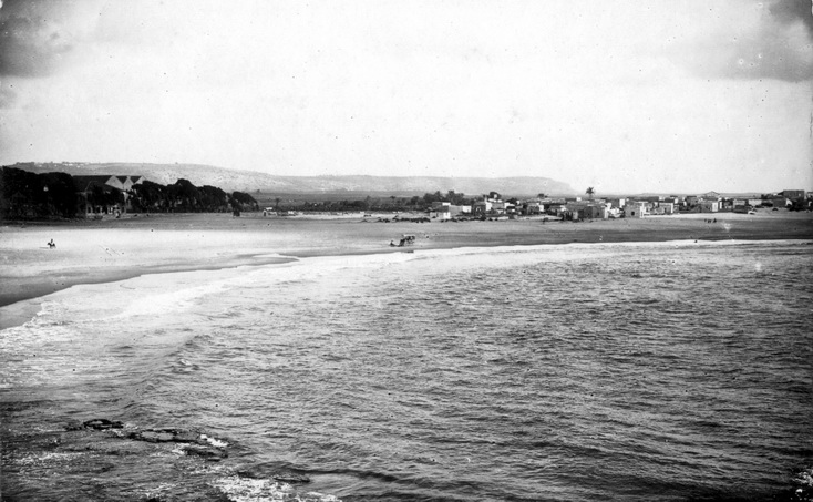
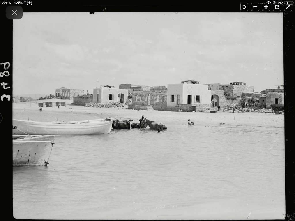
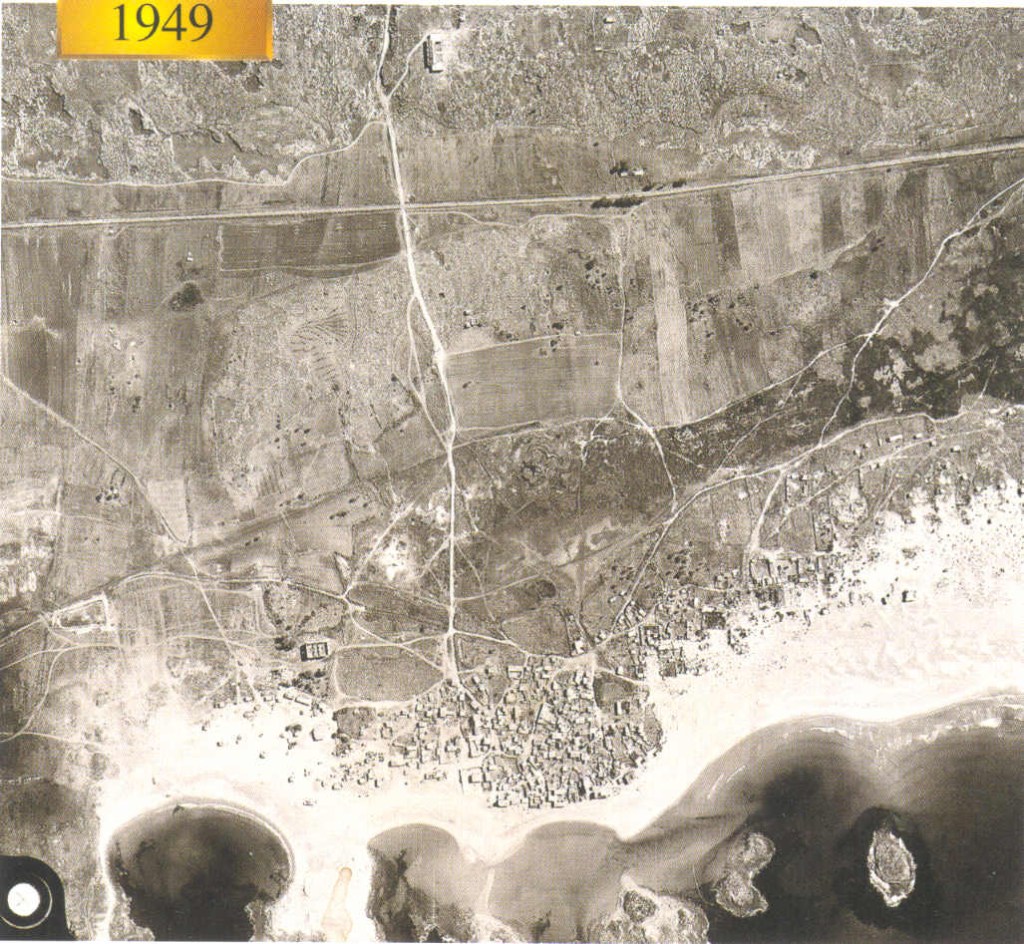
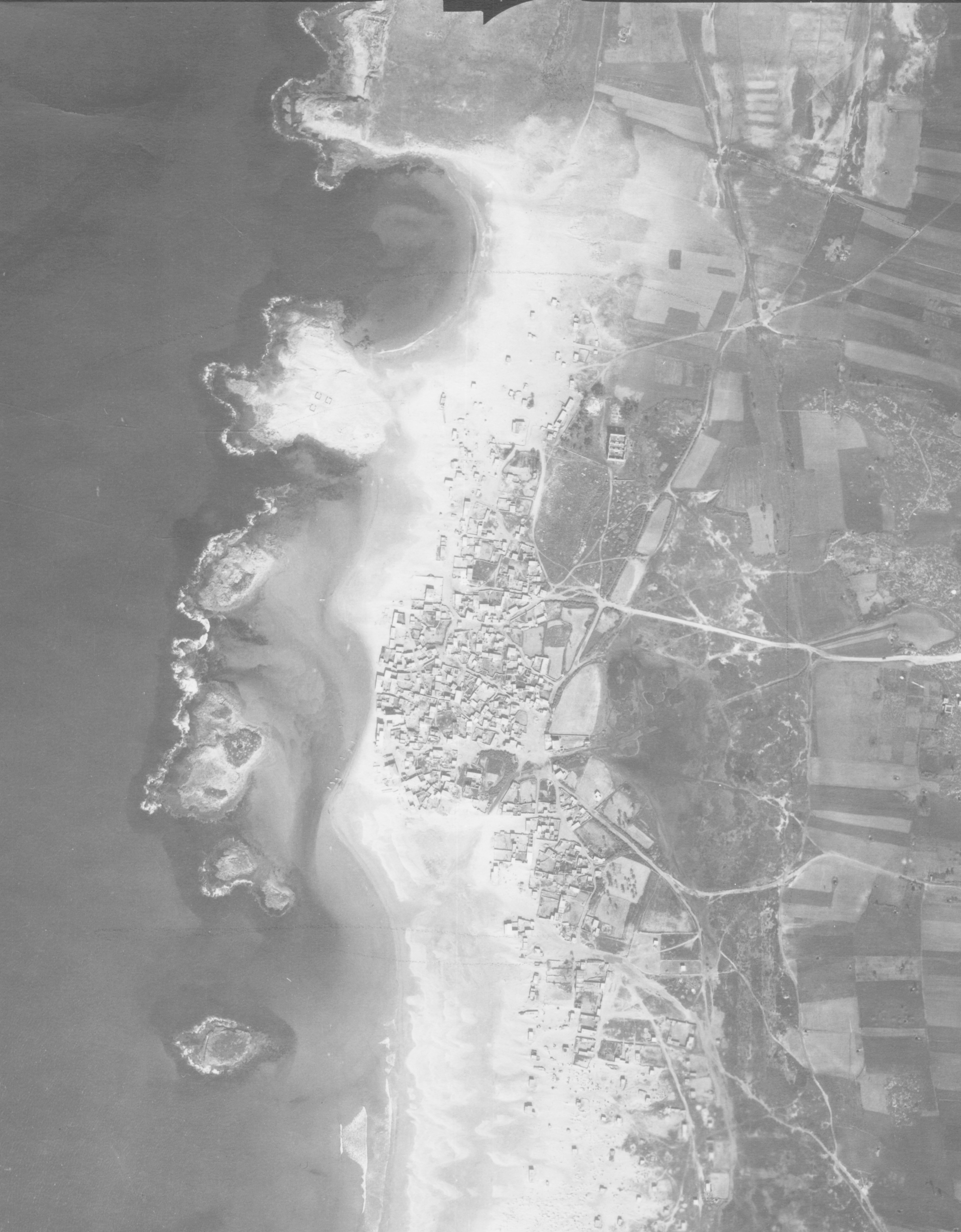
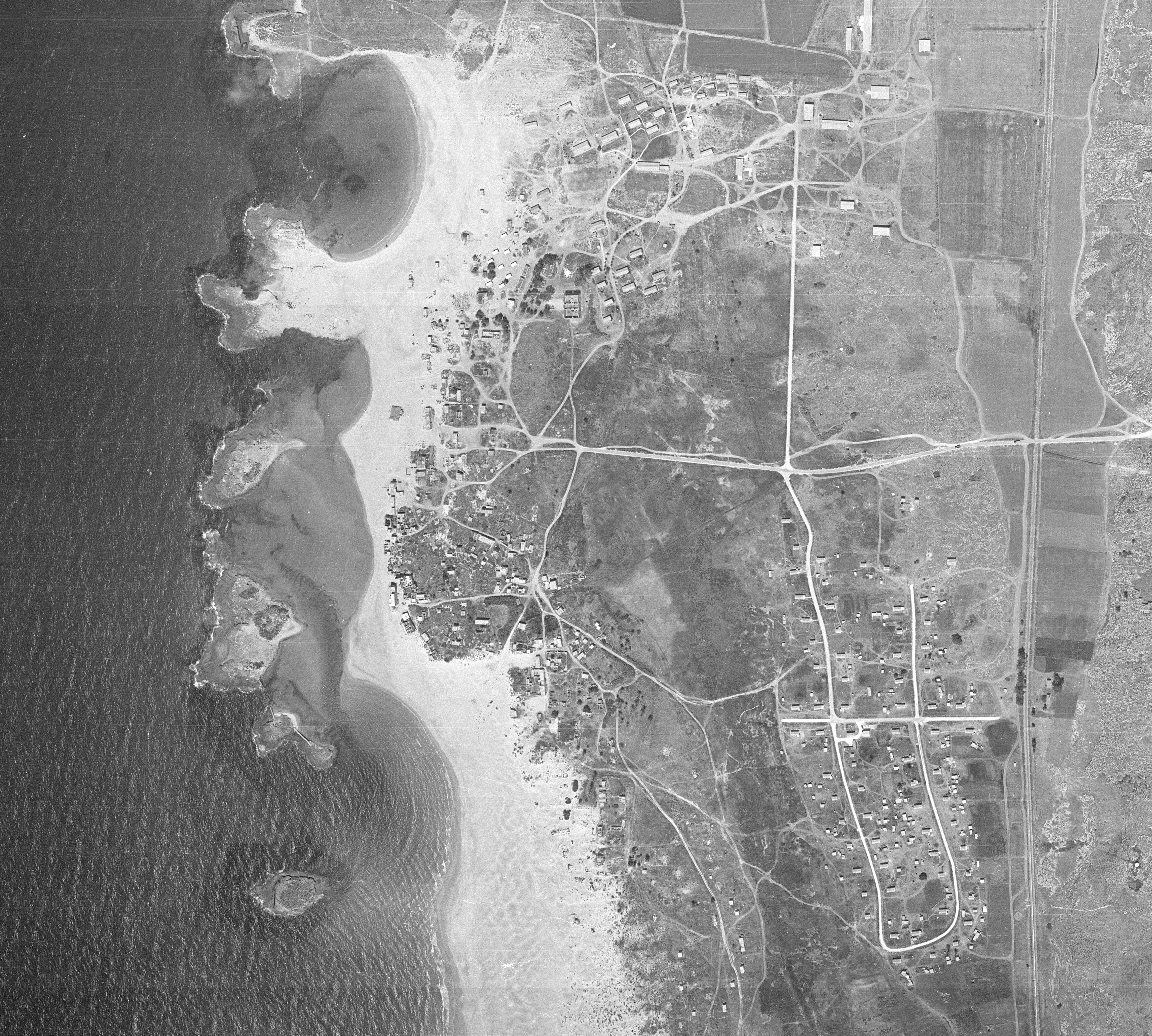
Situated 24 km south of Haifa on a low coastal ridge, al-Tantura was a thriving fishing and agricultural village built directly onto sand dunes, nestled alongside a natural square peninsula and ancient historic harbors.
By early May 1948, al-Tantura stood isolated—one of the very last remaining Palestinian coastal communities along the sweeping expanse between the Zikhron Ya’aqov colony corridors and Tel Aviv. On May 9, a tactical meeting of local intelligence networks finalized the order to “expel or subdue” the village matrix.
The decree was fully realized on the night of **May 22–23, 1948**. The Thirty-Third Battalion of the Alexandroni Brigade executed a concentrated assault from three flanks, collapsing local civilian defense lines within hours.
The Spatial Erasure Matrix
Following mass expulsions to the Triangle and the neighboring enclave of al-Furaydis, the built structure of Tantura was methodically leveled.
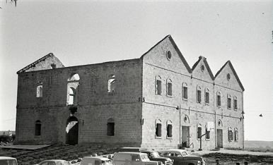
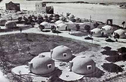
In June 1948, Zionist settlers established **Kibbutz Nachsholim** directly over the northwestern village ruins. By 1949, the settlement of **Dor** was built across the eastern agricultural lands. Today, only a solitary shrine, a scarred fortress section, and one native stone manor house remain amidst an institutional beach resort complex.
The Architecture of Execution & Mass Graves
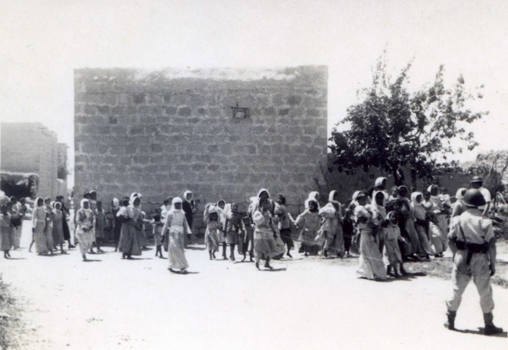
Following the complete military surrender of the village on May 23, hundreds of Palestinian civilians and combatants were corralled onto the beachfront. Systems of selective execution were carried out across the village pathways, alleys, and central plazas.
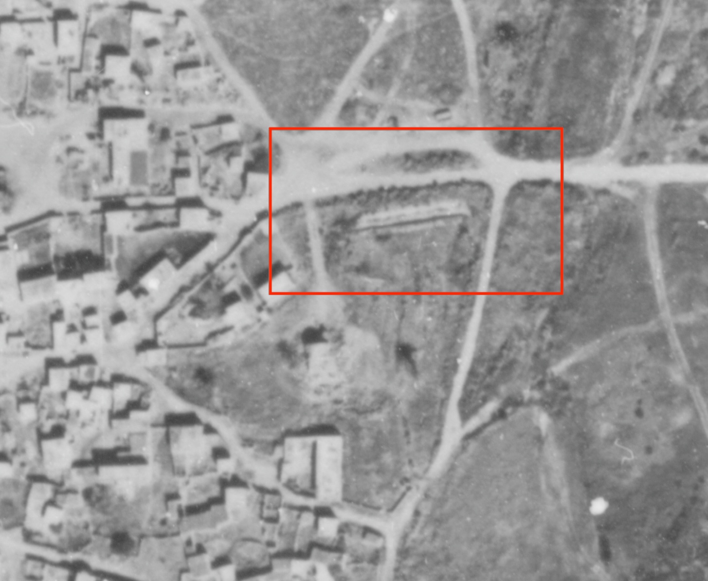
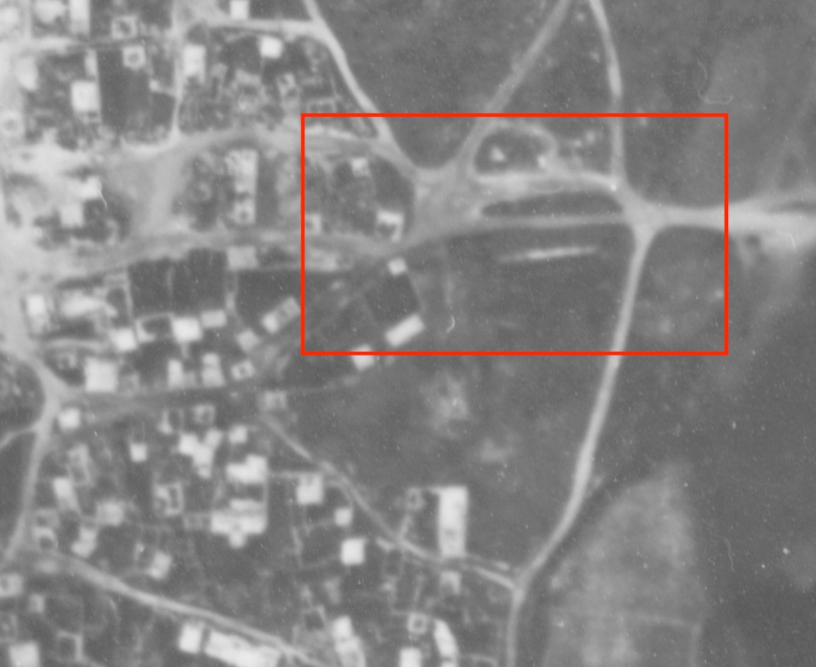
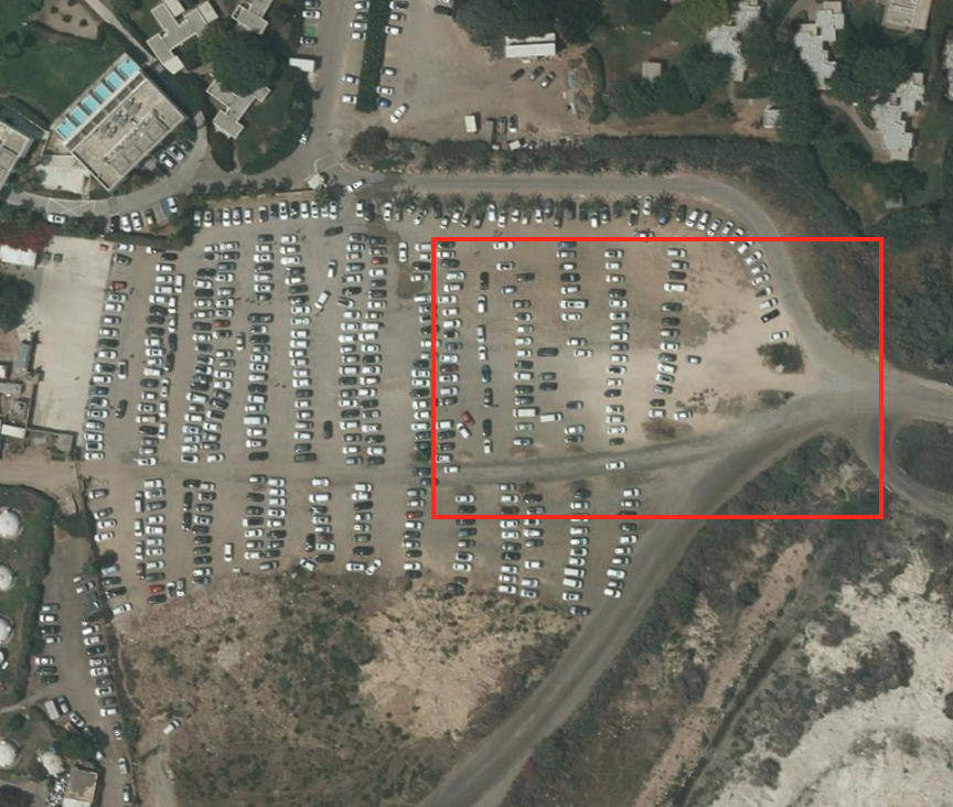
Historical records, survivor testimonies, and modern forensic spatial analysis confirm that **multiple mass graves** were dug to conceal the bodies of over 200 victims. These locations remain un-demarcated beneath what is currently used as an commercial tourist parking lot for Dor Beach.
“They gathered them in the cemetery… they aligned them and shot them. I saw the mass graves being filled with shovel layers…”
VRJPalestine Lab Output
This spatial case study relies on the geographical coordinate registry and historical operation maps preserved such as:
Al-Khalidi, Walid (ed.). All That Remains: The Palestinian Villages Occupied and Depopulated by Israel in 1948. Washington DC: Institute for Palestine Studies, 1992. The Survey Maps by British Mandate, Palestine Remembered, and Plands.


The Encirclement & Systematic Expulsion Matrix
By the beginning of May 1948, al-Tantura was one of the last remaining Arab communities on the stretch of the coastal plain from the Zikhron Ya’aqov area (south of Haifa) to Tel Aviv. On 9 May, a meeting was called of local Haganah intelligence officers and Arab affairs experts to decide on the fate of al-Tantura and a handful of other villages. Historian Benny Morris writes that the decision taken was to ‘expel or subdue’ them.
The History of the War of Independence confirms that the decision was implemented in al-Tantura two weeks later, on the night of 22-23 May. The Haganah’s Thirty-Third Battalion (the Third Battalion of the Alexandroni Brigade) attacked the village, which fell after a brief battle. An Israeli military communiqué, issued on 23 May and quoted by the New York Times, stated: ‘Hundreds of Arabs and a large quantity of booty fell into our hands.’
In June of 1948, Zionist immigrants from the United States and Poland established the kibbutz of Nachsholim, northeast of the site, on village lands. The settlement of Dor, east of the site, was established by Zionist immigrants from Greece in 1949.
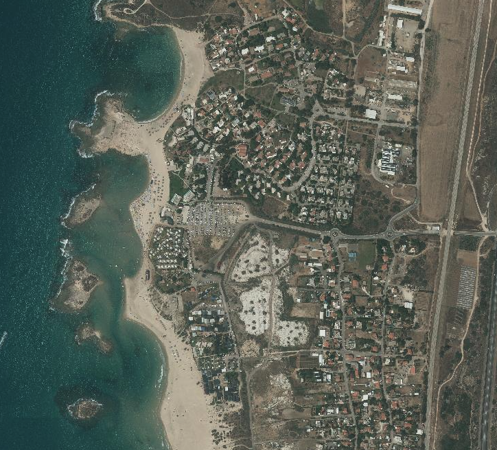
Location Of Tantura Village in Google Map
